Why should it be done professionally? In Greece, most of the times, the paths are cleared and sign-posted by local mountaineering and hiking associations. The input of these associations is very important, and if Greece has several paths open at the moment, it is in large part thanks to these people. Wherever mountaineering clubs do not exist though, or where their activity is limited, the conservation of paths is lacking the required attention. And conservation is the main issue of a hiking trail. In addition, we witnessed several large scale projects about the creation of hiking trail networks, funded with large euros, that after a few years were completely abandoned, since nobody took care of the paths… A path is not a luxurious amenity. It is most of all an investment in quality tourism, able to bring revenues, that are multiple times larger than the costs of implementation and conservation. Step 1: The answer to the above is to see the implementation of a hiking trails network as an investment. The very first thing to do is to see to what extend the paths that we are called to create will attract “customers’ (walkers). This depends on the beauty of the paths, the monuments the pass by, and how accessible they are. In addition, the paths should be rather ease to walk, of short distance (max. 10km), so that the potential “customers” number would be larger. Step 2: If the paths pass the “test” of step one, we carefully design the total network, and decide on the paths that will be sign-posted first. (mainly the best hikes). The signs are carefully designed, and the sign-posting is done with the most extreme precision. Sign-posting is not as easy as it seems, if the rules of a) safety, b) aesthetics and c)
Why should it be done professionally?
In Greece, most of the times, the paths are cleared and sign-posted by local mountaineering and hiking associations. The input of these associations is very important, and if Greece has several paths open at the moment, it is in large part thanks to these people. Wherever mountaineering clubs do not exist though, or where their activity is limited, the conservation of paths is lacking the required attention. And conservation is the main issue of a hiking trail. In addition, we witnessed several large scale projects about the creation of hiking trail networks, funded with large euros, that after a few years were completely abandoned, since nobody took care of the paths…
A path is not a luxurious amenity. It is most of all an investment in quality tourism, able to bring revenues, that are multiple times larger than the costs of implementation and conservation.
Step 1:
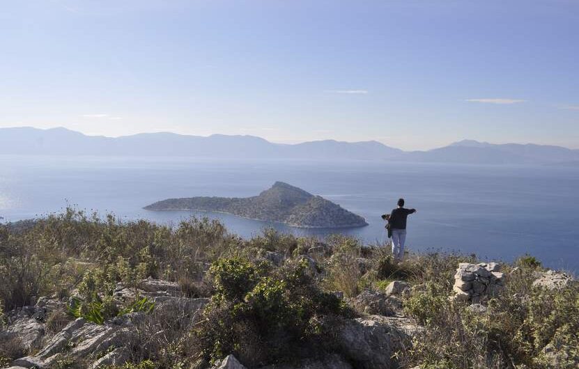
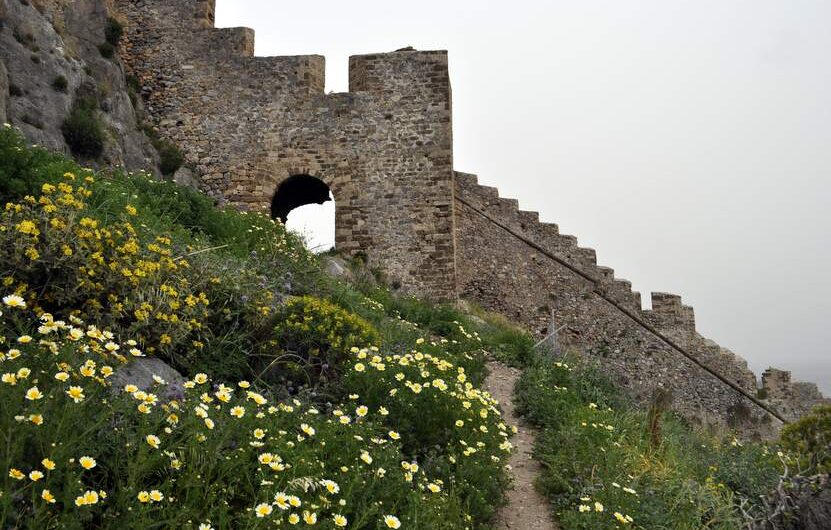
The answer to the above is to see the implementation of a hiking trails network as an investment. The very first thing to do is to see to what extend the paths that we are called to create will attract “customers’ (walkers). This depends on the beauty of the paths, the monuments the pass by, and how accessible they are. In addition, the paths should be rather ease to walk, of short distance (max. 10km), so that the potential “customers” number would be larger.
Step 2:
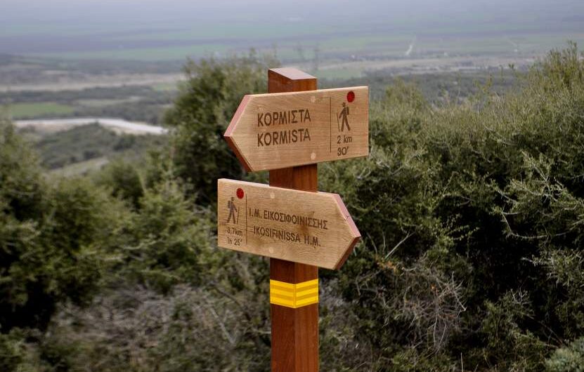
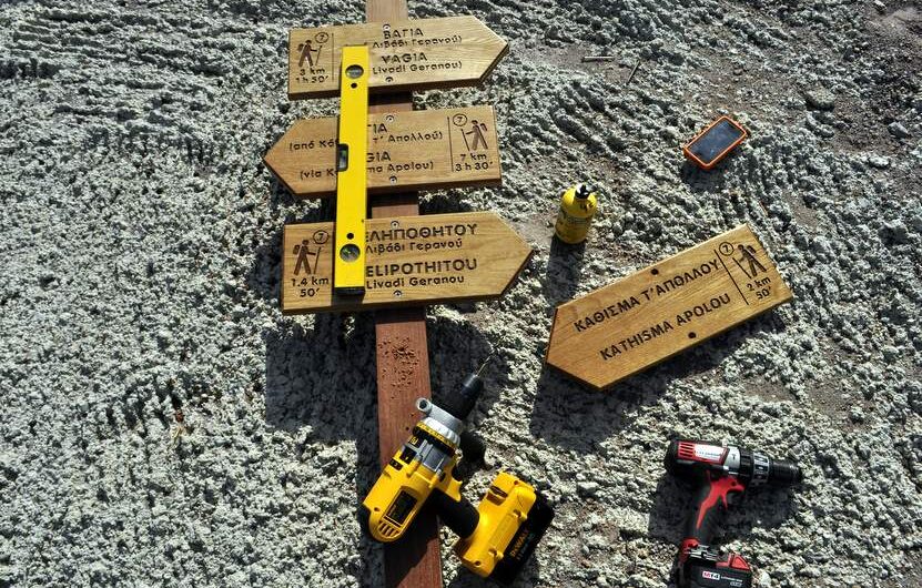
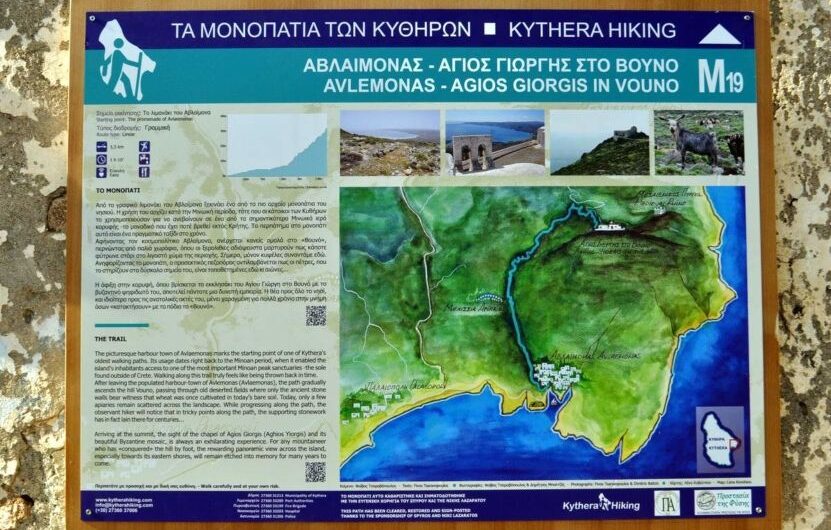
If the paths pass the “test” of step one, we carefully design the total network, and decide on the paths that will be sign-posted first. (mainly the best hikes). The signs are carefully designed, and the sign-posting is done with the most extreme precision. Sign-posting is not as easy as it seems, if the rules of a) safety, b) aesthetics and c) right kind of materials, are used. In parallel, it is very important to communicate with the local population, and especially with businessmen in hosting and restoration. These last ones have a lot to gain from the existence of a trails network, and would surely assist the works of conservation for the years to come.
Step 3:
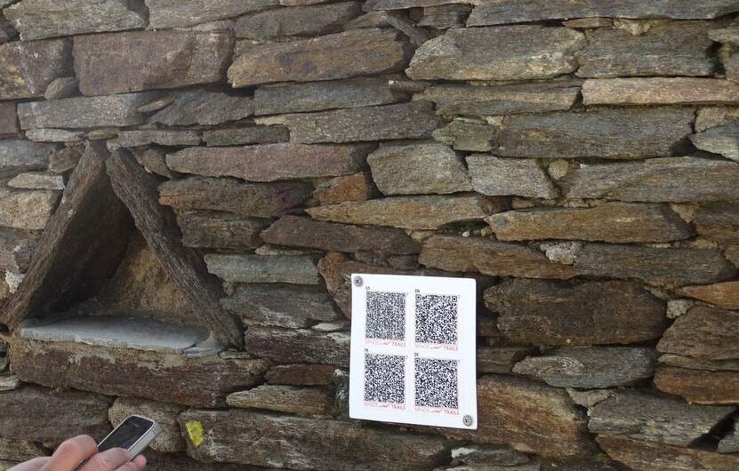
After the implementation of the signs, starts the very important step of promotion. This is mainly done through a website dedicated to the paths network and through a leaflet that would be freely distributed to businesses of the area and to tourists (either they came for walking or not). Of high importance is also the communication with mountaineering and hiking clubs around Greece, who should be invited to come and visit the place.
Step 4:
After 1 or 2 years, in relation with the dynamics of the hiking network, calculated fron the amount of tourists that visit it and the increase rate of this amount, several other trails could be added to the network, giving a larger selection of walks.
To follow these steps and achieve the desired results, a correct planning from the beginning is required. We should always keep in mind the economic viability of the project. And of course, volunteering actions can only add more to the project. In the design and the implementation of the first steps, the “Paths of Greece” are here for you, strong of experience. The next steps should be yours!