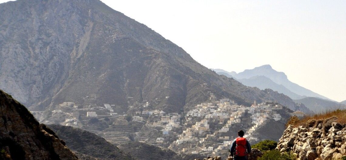
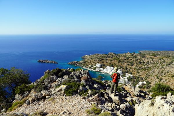
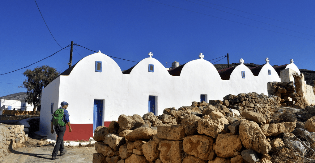
Exploring Karpathos island Karpathos is one of the most authentic places in Greece, with an incredible trails network. The article speaks about an exploration from south to north of this island. The article only appears in the Greek version (click the Greek flag at the top right corner of your screen). Here you can
Special offers for HIKERS FRIENDLY travellers! We have recently launched a series of special #hikersfriendly offers, in an attempt to propose alternative traveling experiences, with a strong hiking element, for friends that are currently planning their summer – and autumn – excursions around Greece, and want to get to know some of the most
(Ελληνικά) Οδοιπορικό στην Κάσο Sorry, this entry is only available in Greek.
[fusion_builder_container hundred_percent=”no” hundred_percent_height=”no” hundred_percent_height_scroll=”no” hundred_percent_height_center_content=”yes” equal_height_columns=”no” menu_anchor=”” hide_on_mobile=”small-visibility,medium-visibility,large-visibility” class=”” id=”” background_color=”” background_image=”” background_position=”center center” background_repeat=”no-repeat” fade=”no” background_parallax=”none” enable_mobile=”no” parallax_speed=”0.3″ video_mp4=”” video_webm=”” video_ogv=”” video_url=”” video_aspect_ratio=”16:9″ video_loop=”yes” video_mute=”yes” video_preview_image=”” border_size=”” border_color=”” border_style=”solid” margin_top=”” margin_bottom=”” padding_top=”” padding_right=”” padding_bottom=”” padding_left=””][fusion_builder_row][fusion_builder_column type=”1_1″ layout=”1_1″ spacing=”” center_content=”no” link=”” target=”_self” min_height=”” hide_on_mobile=”small-visibility,medium-visibility,large-visibility” class=”” id=”” background_color=”” background_image=”” background_position=”left top” background_repeat=”no-repeat” hover_type=”none” border_size=”0″ border_color=”” border_style=”solid”
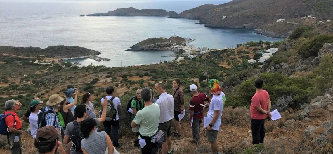
Kythera Trails becomes the 1st Green Flag certified trails in Europe In early October 2019, trail professionals from 13 countries gathered on the island of Kythera, Greece, for the training of trail auditors using the Green Flag Trails certification led by the World Trails Network. During the 7-days long course, a selection of Kythera’s trails were audited and three

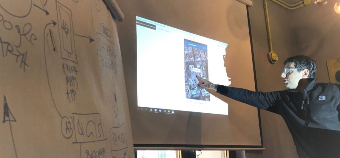
Consultancy in Japan In October 2019, Fivos Tsaravopoulos, co-founder of Paths of Greece, visited Japan on a trail development consultancy trip. His long lasting involvement with the World Trails Network, Fivos has been called on board an international team of experts that traveled to Miyagi, Japan, in order to consult on the development of the Miyagi
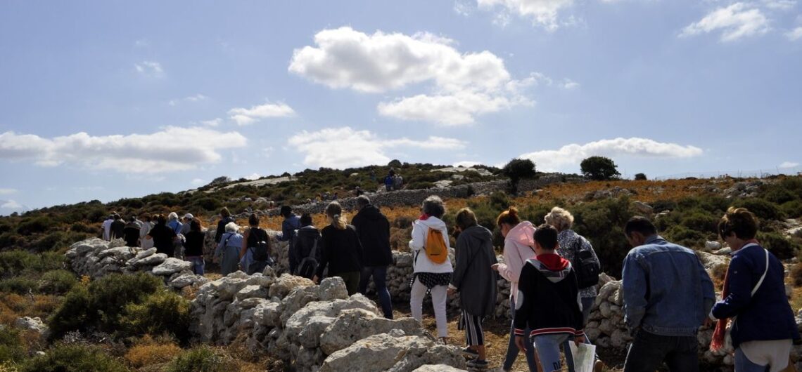
Onithe Archaeological Footpath In September 2019, we inaugurated the Onithe Archaeological Footpath, the best way to visit the archaeological site of Onithe in Goulediana village, Rethymnon, Crete. The footpath meanders through the mysterious archaeological site of Onithe, only scarcely explored by archaeologists. Walking the footpath, one can visit the most important sites of Onithe,
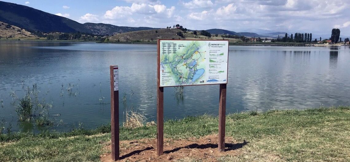
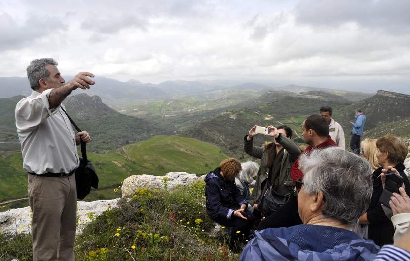
Paths of Peace In summer 2019, we implemented a multi-day hiking trail and a cycling route called Paths of Peace. It is located in the area of Florina, Western Macedonia, Greece. The trail is divided into 4 hiking days, and it starts and ends at Lehovo village. It crosses the most important natural and

Ithaca Trails Ithaca Trails, the official network of hiking trails of Ithaca island is now a fact. Together with the Municipality of Ithaca, Paths of Greece has implemented the first set of routes – 50km, 7 trails. These trails have been cleared and sign-posted, and will soon be presented through a website and an
Tinos Trails Tinos Trails, the official hiking network of Tinos island is a fact! 152 km of trails, planned according to the hiker needs, invite you to discover the nature and culture of this beautiful island of the Cyclades. Tinos Trails is a project of the Municipality of Tinos, in co-operation with Paths of
Trail design, mapping & sign-posting workshop in Tirana Paths of Greece and Mr. Spyros Staridas (Staridas Geography) had been invited by the inspired team of Tirana Ekspres, in Albania for a workshop. The scope of the visit was a seminar about the use of GIS software, trail mapping and sign-posting preparations. The Tirana Ekspres team
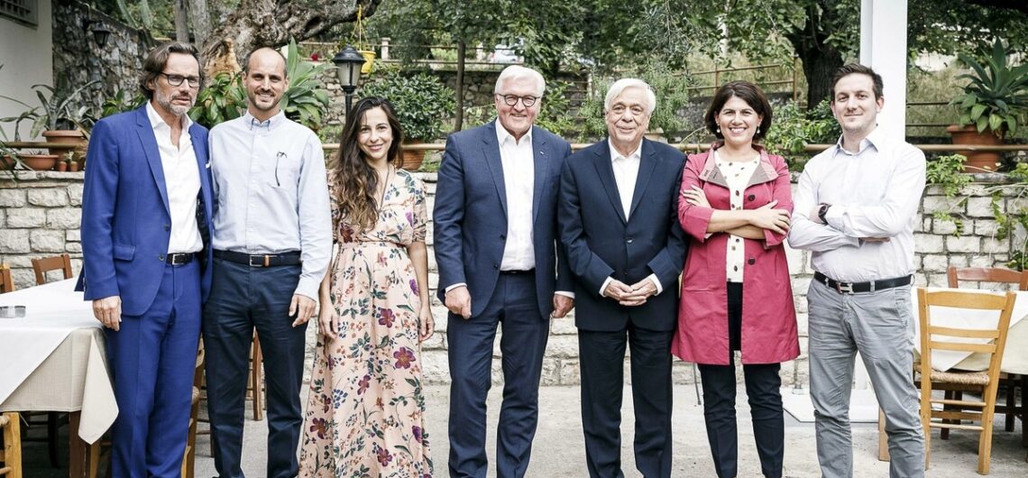
8 years Paths of Greece At its 8th birthday, Paths of Greece has been presented to the President of the Federal Republic of Germany, Mr. Frank Walter Steinmeier during his visit in Greece Last October, Paths of Greece became 8 years old. When it all started, it seemed an impossible attempt. During the crisis years,
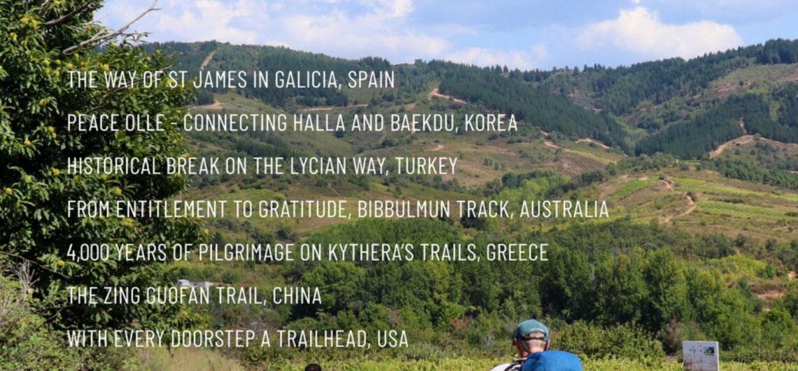
New Trails Around the World Magazine We are proud to present our new article about the trails of Kythera in the 4th edition of the World Trails Magazine “Trails Around the World”. Our article, written by Fivos Tsaravopoulos and Rigas Zafeiriou presents a 4000 years old pilgrimage route on the island of Kythera, linking
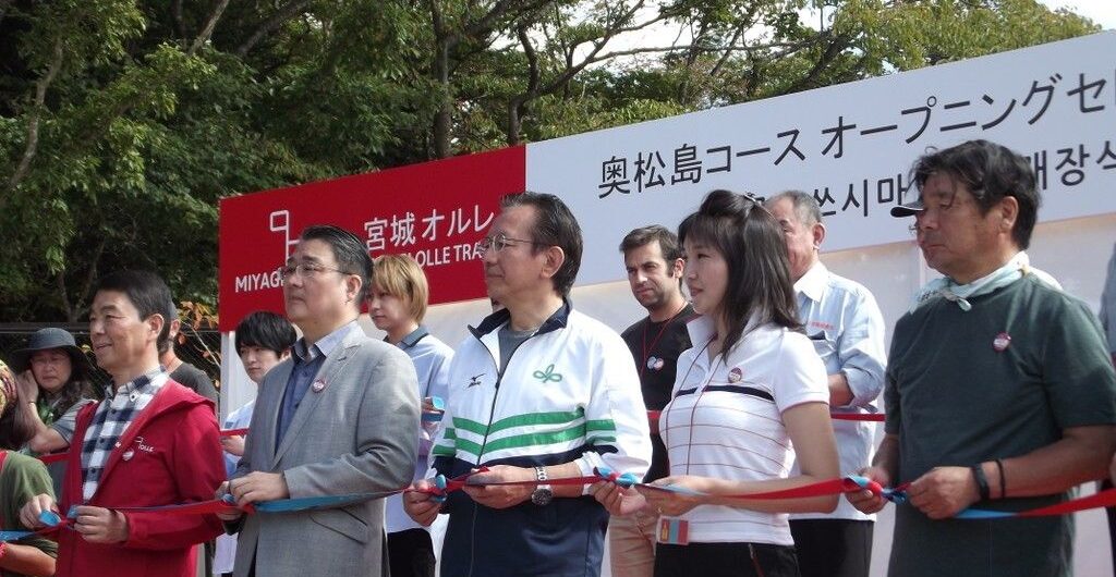
Miyagi Olle opening ceremony (Japan) Miyagi Olle trail: walking towards the path of financial recovery. The beginning of October saw the grand opening of the trail network Miyagi Olle in Miyagi prefecture of North-Eastern Honshu in Japan. Paths of Greece were invited to the opening ceremony and our representative, Sotiris Dimos, went there. As part
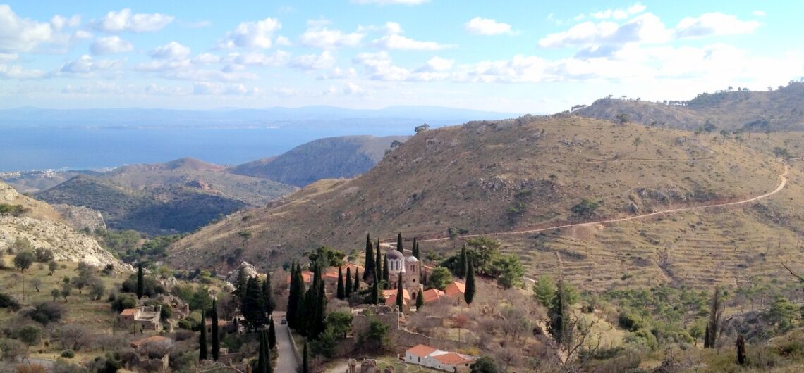
Apollo Trails We have just inaugurated the Apollo Trails, a small but wonderful trail network on Mountainous Messinia (Peloponnese). The trails start at the village of Abeliona, and link the neighbouring settlements of Neda, Petra, Agios Sostis, Skliros, to the UNESCO Temple of Apollo Epicurius, the Temple of Pan, the springs of Neda, numerous stone-built thresholds,

7th World Trails Conference Paths of Greece has participated at the 7th World Trails Conference, that took place from September 26th – 29th, in Santiago de Compostela, Spain. During the Conference, we have presented the Hikers Friendly Certification, made a lot of contacts, and worked on the creation of a World Trails Network – Mediterranean
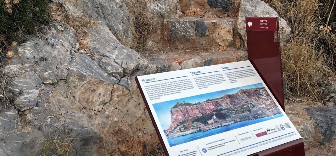
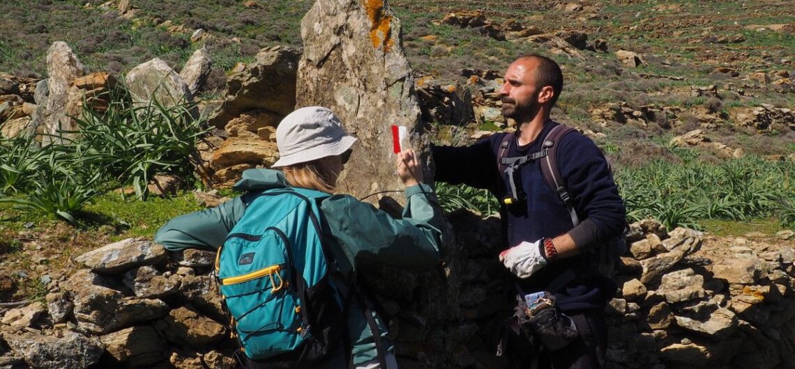
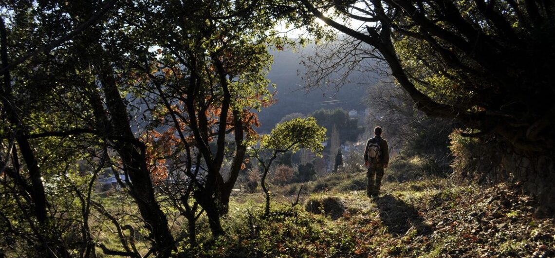
New waymarking in Monemvasia We have recently installed new trailhead signs in Monemvasia, from durable, 10-year guarantee boards. We have also way-marked a short trail that links to the Central Gate of the Lower City. The project has been completed with the collaboration of the Association Friends of the Castle of Monemvasia. For more
What is the impact of trails length By the end of June, I found myself again in a favorite island, Chios, which I am closely following for the efforts they make with the hiking paths. In Chios, there are hiking routes being constructed by the ex-prefecture of Chios, there is the Association “Friends of Paths
The hotel certification standard has been launched! “Hikers’ Friendly” is a certification for services related to hiking activities. It is currently available only for hotels, but it will soon be open for other sectors. It has been developed by the Social Co-operative Paths of Greece, in collaboration with Green Evolution. Its aim is to enhance
Meeting for the promotion of the archaeological site of Onithe, in Crete On Friday, April 21st, in the village of Goulediana, in Crete, took place the second meeting in order to promote the archaeological site of Onithe. The meeting was organised by the greek magazine “Archaeology and Arts“. For more information, please see the Greek version of