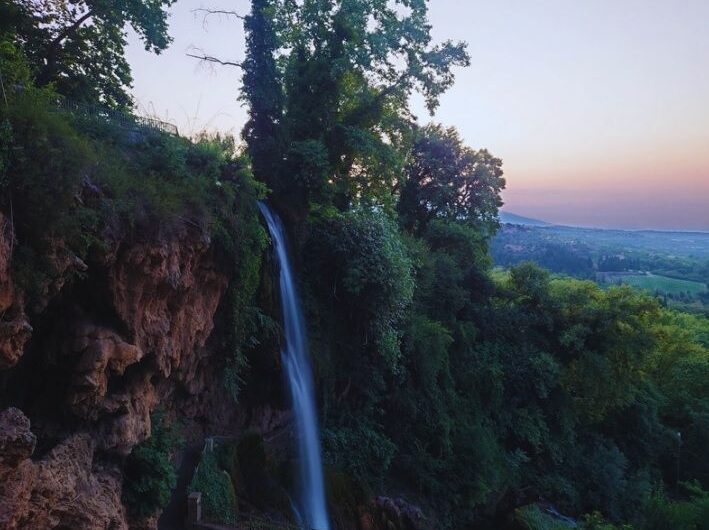
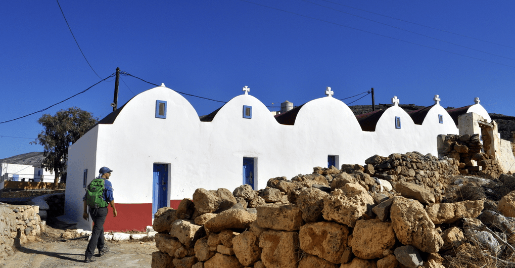
Invitation to participate in the three-day hiking trip in Edessa! After the events in Italy, HIKE moves to Greece in October 2024. The town of Edessa will be the focal point for a series of outdoor events, combining hiking, cultural activities, and workshops organised by us and the municipality of Edessa from October 11th to
The Launch of the HIKE Project Embark on a Journey to Well-being: The Launch of the HIKE Project The European project “HIKE: HIKing for a healthier lifestylE along European Cultural Routes” kicked off on 1 April 2024. This Erasmus+ Sport project aims to increase healthy and active lifestyles via engagement of local communities into
Getting to know the Central European Trail Waymarking Reading the entire article takes about 8 minutes. Alternatively, you can continue directly to the conclusions by clicking here. “They know better abroad!” “I’ve walked the Alps and I know!” “What are the European standards?” “Let’s get the Austrians to show us how it’s done!” These and
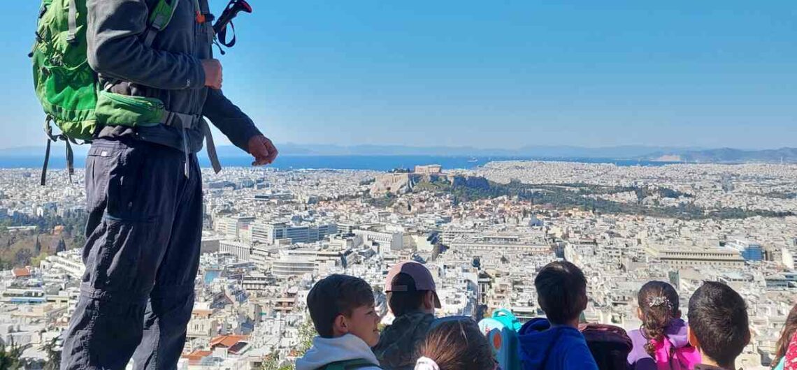
Educational program: “Exploring the hill of Lycabettus” On March 30, the first step was taken in a plan that had started before the appearance of Covid-19 in our lives. That is the educational program: “Exploring the hill of Lycabettus” that we developed, in collaboration with teachers, through which we aim to bring children into
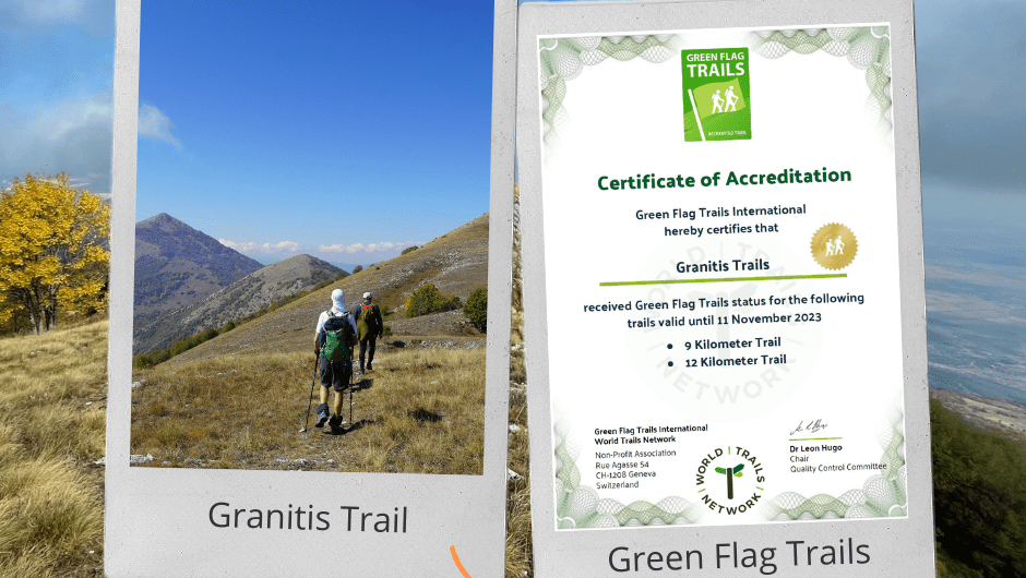
Granitis Trail Certification The second Green Flag Trails certification in Greece is a fact! The Granitis Trail has been officialy certified with the only global certification for trails, the Green Flag Trails! Thanks to the tremendous efforts of Nikos Bourlivas, who has created the Granitis Trail, and the kind sponsorship and support Raycap, the trail has been
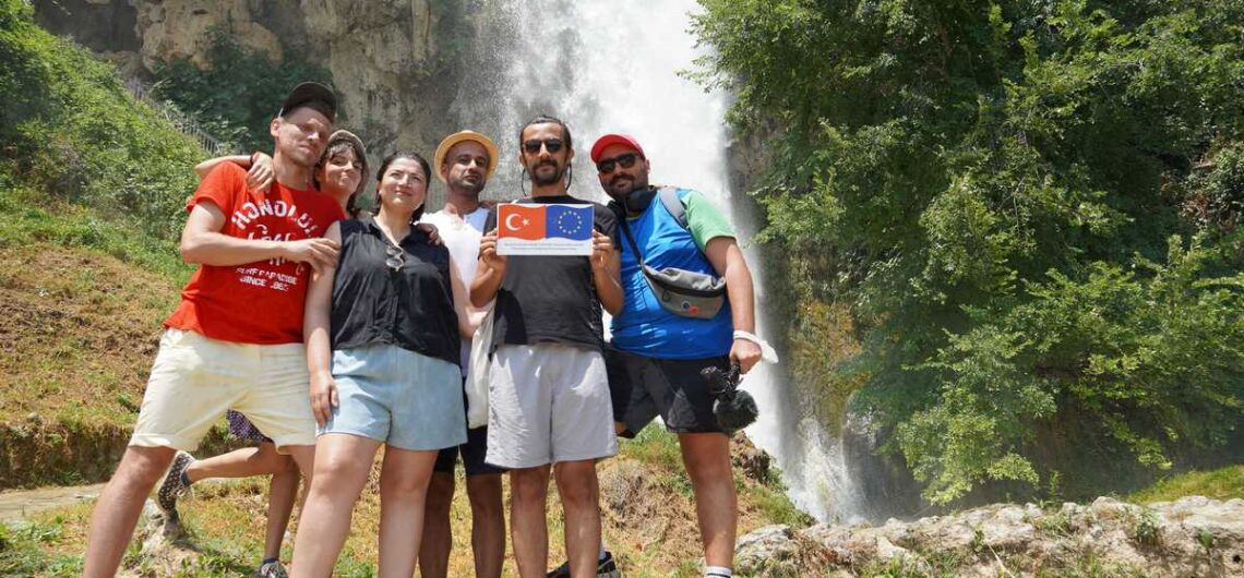
Performative Journey EU Project With our partners MitOst (Germany), Culture Routes Society (Turkey) and Tirana Ekspres (Albania), who are committed in the development of Via Eurasia – a long-distance cultural route and walking trail running from Rome, across Italy and the Balkans, through western Turkey to Demre on the Lycian coast of Turkey’s southwest and beyond we are working on an EU

Bike Friendly – Paths of Greece Paths of Greece and Bike Friendly Hotels have signed a Memorandum of understanding for their close co-operation in the fields of developping cycling destinations. Through their co-operation, both organisations have agreed to work closely in promoting cycling tourism, creating adequate infrastructure and develop a network of high quality
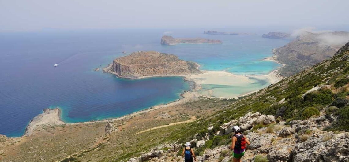
Trail planning in Kisamos Paths of Grecce’s team has been trail planning for about a month in Kisamos, western Crete, in order to design the new hiking network of the area. For several days, Konstantinos, Ioanna, Vasilis and Guest Star Helen, have explored every single bit of the Kisamos Municipality, have tracked the trails
New Kythera Trails Videos Check out the new set of videos produced for the Kythera Trails. Some of these have been created and some co-funded by Paths of Greece.
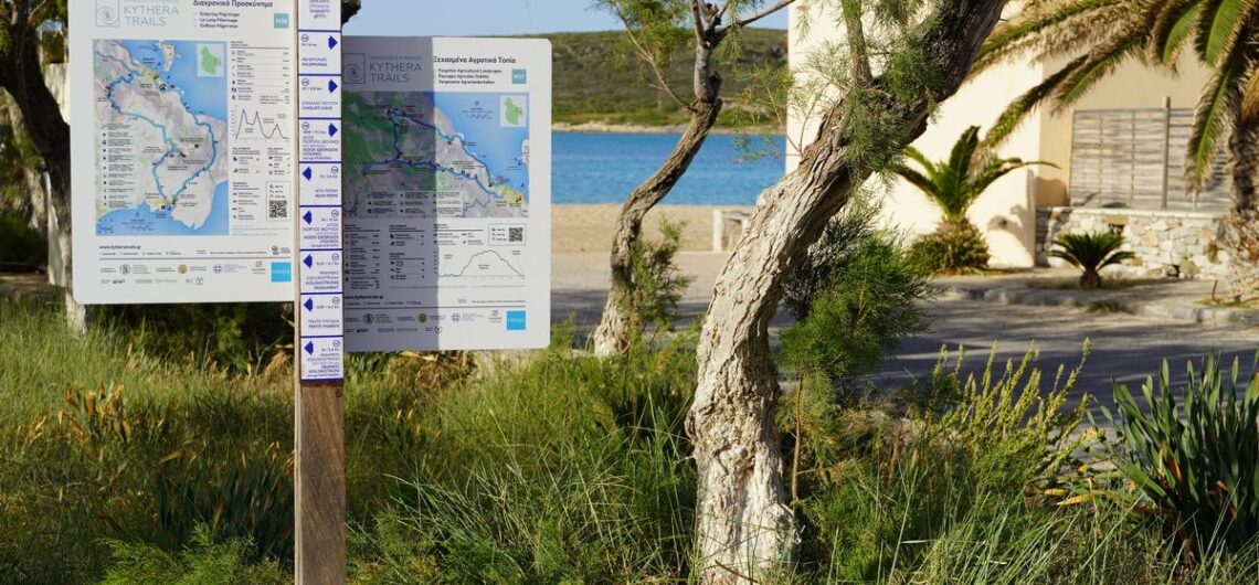
New trailhead signs for Kythera Trails New trailhead signs have been installed on the Kythera Trails Network! 24 trailhead signs have been installed in 16 traditional villages, welcoming hikers on the 11 trails of the network. The signs boast the logo of the identity of each trail, with plenty of information being at the
Metropolitan Trails Academy Launch In the last two years, the European network of metropolitan trails designers, located in Athens, Köln, London, Milano, and Marseilles, has prepared online teaching tools to enable the creation of metropolitan trails in new cities. In this prospect, we recently opened the online version of the Metropolitan Trails Academy and invite you
Cycling Trails in the Peloponnese The beauty of Greece lies in its most unexpected places. Enjoy this short video that we shot while cycling in the mountainous part of Messinia, Peloponnese, Greece. Paths of Greece has been recently exploring the mountainous Messinia region in order to design a cycling trails network, to complete the Apollo Trails hiking
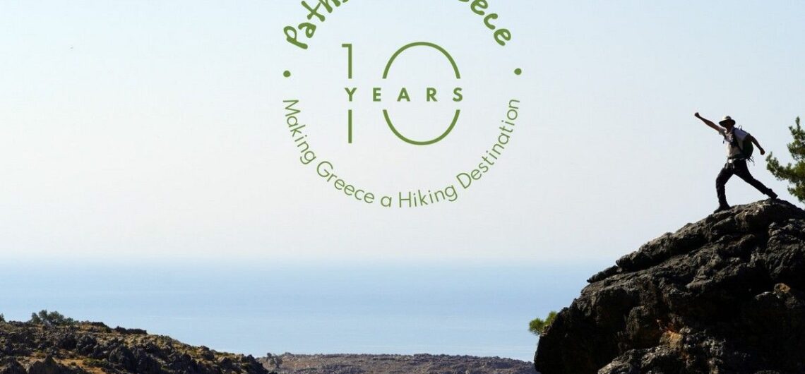
10 years Paths of Greece! In 2021 the Social Cooperative Enterprise “Paths of Greece” celebrates its 10th anniversary! We recall the experiences and emotions we experienced in this process: The emotions we felt looking for paths lost in time and the stories of the past, the stories we learned in our encounters with local
A Path for the Disabled as Skiathos Trails enter a new Era In 2021, the walking trails of Skiathos will be ready for hikers to explore this beautiful island. Their total length exceeds 100 kilometers. Paths of Greece has recently conducted the study of the project, which includes the re-shaping of the trails network, infrastructure
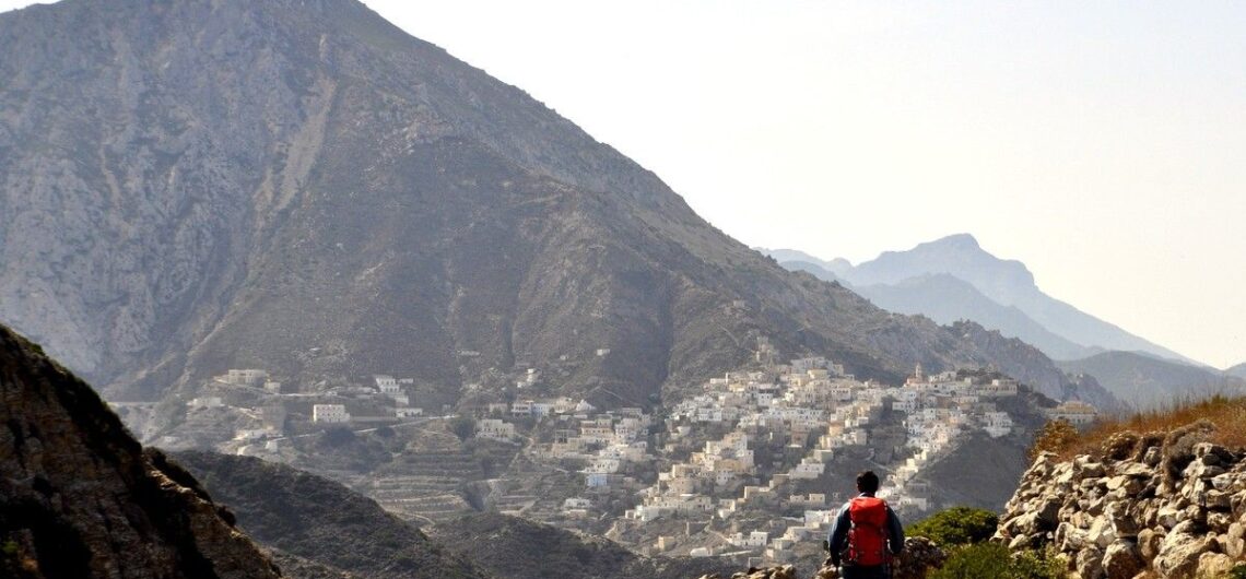
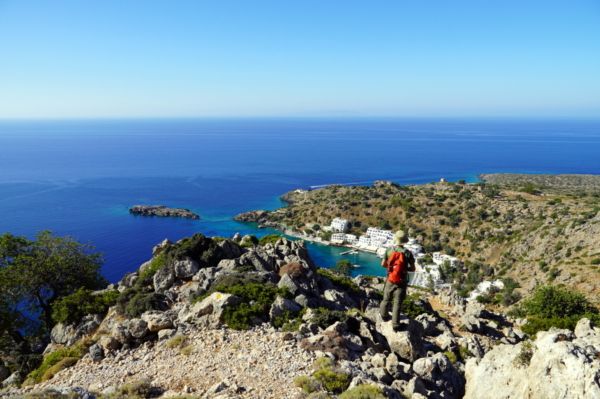
Exploring Karpathos island Karpathos is one of the most authentic places in Greece, with an incredible trails network. The article speaks about an exploration from south to north of this island. The article only appears in the Greek version (click the Greek flag at the top right corner of your screen). Here you can
Special offers for HIKERS FRIENDLY travellers! We have recently launched a series of special #hikersfriendly offers, in an attempt to propose alternative traveling experiences, with a strong hiking element, for friends that are currently planning their summer – and autumn – excursions around Greece, and want to get to know some of the most
(Ελληνικά) Οδοιπορικό στην Κάσο Sorry, this entry is only available in Greek.
[fusion_builder_container hundred_percent=”no” hundred_percent_height=”no” hundred_percent_height_scroll=”no” hundred_percent_height_center_content=”yes” equal_height_columns=”no” menu_anchor=”” hide_on_mobile=”small-visibility,medium-visibility,large-visibility” class=”” id=”” background_color=”” background_image=”” background_position=”center center” background_repeat=”no-repeat” fade=”no” background_parallax=”none” enable_mobile=”no” parallax_speed=”0.3″ video_mp4=”” video_webm=”” video_ogv=”” video_url=”” video_aspect_ratio=”16:9″ video_loop=”yes” video_mute=”yes” video_preview_image=”” border_size=”” border_color=”” border_style=”solid” margin_top=”” margin_bottom=”” padding_top=”” padding_right=”” padding_bottom=”” padding_left=””][fusion_builder_row][fusion_builder_column type=”1_1″ layout=”1_1″ spacing=”” center_content=”no” link=”” target=”_self” min_height=”” hide_on_mobile=”small-visibility,medium-visibility,large-visibility” class=”” id=”” background_color=”” background_image=”” background_position=”left top” background_repeat=”no-repeat” hover_type=”none” border_size=”0″ border_color=”” border_style=”solid”
Kythera Trails becomes the 1st Green Flag certified trails in Europe In early October 2019, trail professionals from 13 countries gathered on the island of Kythera, Greece, for the training of trail auditors using the Green Flag Trails certification led by the World Trails Network. During the 7-days long course, a selection of Kythera’s trails were audited and three

Consultancy in Japan In October 2019, Fivos Tsaravopoulos, co-founder of Paths of Greece, visited Japan on a trail development consultancy trip. His long lasting involvement with the World Trails Network, Fivos has been called on board an international team of experts that traveled to Miyagi, Japan, in order to consult on the development of the Miyagi