Category: Education

The Launch of the HIKE Project

Embark on a Journey to Well-being: The Launch of the HIKE Project


The European project “HIKE: HIKing for a healthier lifestylE along European Cultural Routes” kicked off on 1 April 2024.
This Erasmus+ Sport project aims to increase healthy and active lifestyles via engagement of local communities into hiking and related sports activities along historic routes, such as Via Francigena, η Via Egnatia and Via Eurasia – Tolerance way.

With a budget of 200,000 euros allocated for a duration of 18 months, the project activities will unfold in three countries – Italy, Greece, and Turkey, and bring together three associations – Turkish Culture Routes Society (project leader), the European Association of the Via Francigena Ways (AEVF), and the Social Co-operative Enterprise “Paths of Greece”.

A series of free hiking events are scheduled along the trails:

  1. Via Francigena in the Puglia region, Italy (September 2024)
  2. Via Egnatia near Edessa, Greece (October 2024)
  3. Via Eurasia – Tolerance Way, in the vicinity of Izmit, Turkey (November 2024)

With an ambition to inspire locals to follow a healthy lifestyle, through physical activity and social cohesion. Accompanied by experienced hikers, participants will be invited to follow in the footsteps of historical voyagers, connect with the past, and forge new links with their local heritage and fellow walkers. Through a blend of workshops and activities, the initiative will highlight the health benefits of hiking and thus strengthen hiking tourism.

The project will include the celebration of the European Week of Sport 2024 (23 – 30 September 2024), with events designed to portrait walking and hiking as a universally accessible, all-year-round activity for participants of all backgrounds and abilities, offering a welcoming environment for sports enthusiasts and novices alike.

Apart from promoting the creation of walking infrastructure for both locals and visitors, the initiative will empower local municipalities and associations with a methodology for organizing hiking events.

Join us as we embark on this extraordinary journey of discovery and well-being and stay tuned to receive updates on the upcoming hikes that are going to be organized through the HIKE project!
https://ec.europa.eu/info/fundingtenders/opportunities/portal/screen/opportunities/projects-%20details/43353764/101134001/ERASMUS2027?order=DESC&pageNumber=1&pageSize=50&sortBy=ti%20tle&keywords=HIKE&programmePeriod=2021-2027

Getting to know the Central European Trail Waymarking

Reading the entire article takes about 8 minutes.

Alternatively, you can continue directly to the conclusions by clicking here.


“They know better abroad!”

“I’ve walked the Alps and I know!”

“What are the European standards?”

“Let’s get the Austrians to show us how it’s done!”

These and many other expressions reach our ears at times. So we decided to go and see for ourselves what these foreigners are up to!

On the occasion of the organization of a related educational trip by the World Trails Network and the “Sustainability Task Team”, led by our friend András Joszef Molnar from Hungary, we found ourselves discovering something new every day about trails and waymarking in central Europe. And we were left speechless!

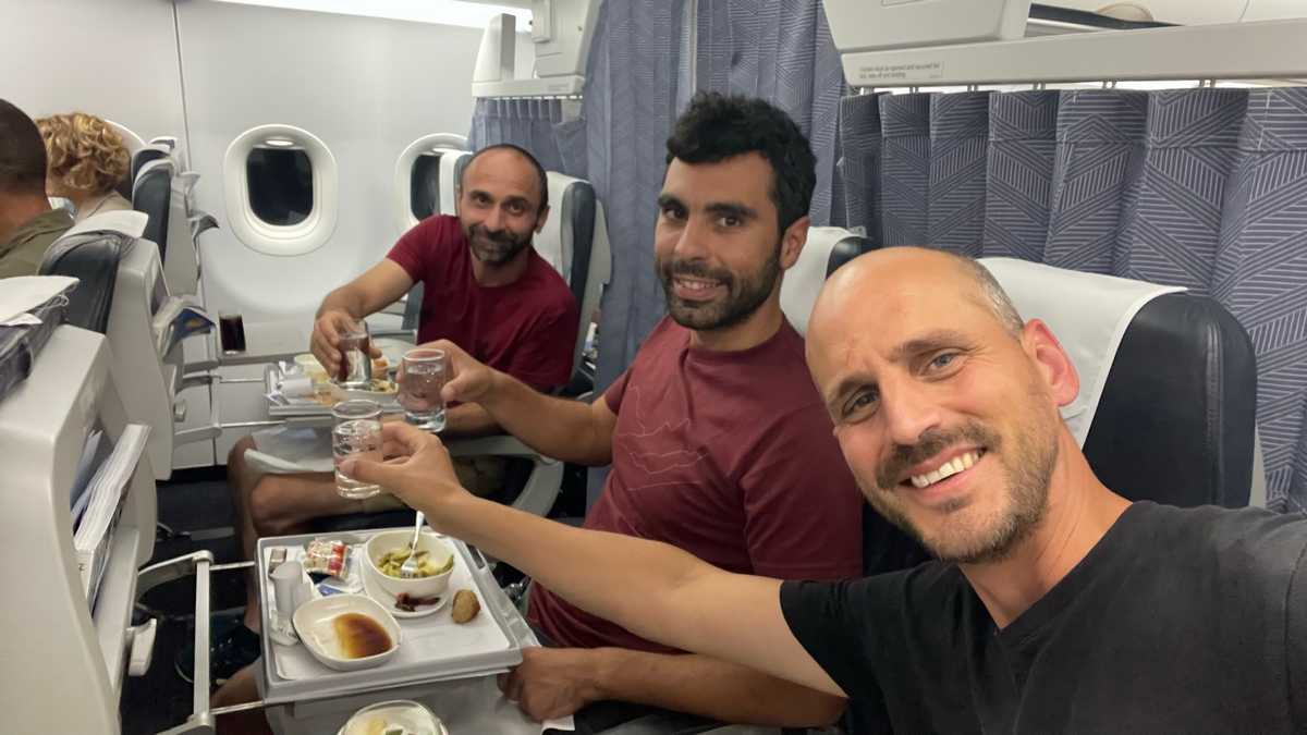
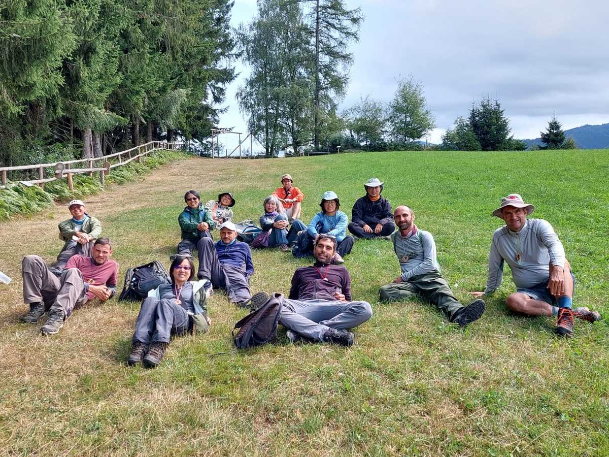
Our journey started in Slovenia, continued to Italy, then Austria and Hungary and ended in Slovakia. Its total duration was 6 days. From Paths of Greece we were Antonis (Signage Expert), Konstantinos (Trail Planner) and Fivos (Manager). Accompanying us were the TMI Trail team from Taiwan, who have done perhaps the best job in the world of documenting and analyzing trail and hiking related topics. And of course, the whole journey was designed and edited by András Joszef Molnár who has worked on the design of Hungary’s national signage system.

Day 1 – Slovenia

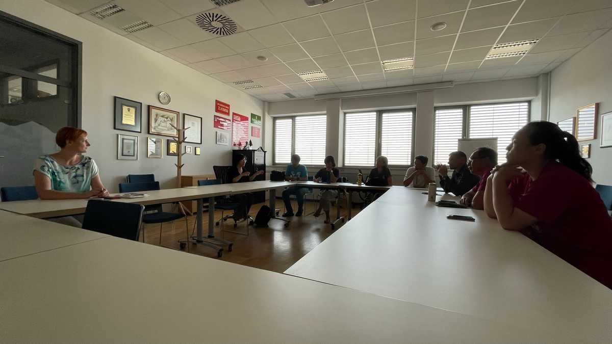
We arrived by plane in Vienna and by van to the capital of Slovenia, Ljubljana. There, we met up with the rest of the team (Taiwan and András) and met the Slovenian national mountaineering federation, where they explained the country’s trail marking, organization and management system in detail.

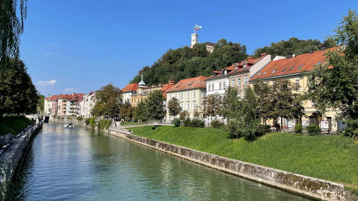
Afterwards, we were guided around the city and its castle, where we also had the opportunity to see trail waymarking within the city.

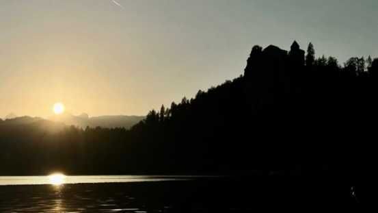
In the afternoon we saw a wonderful sunset on Lake Bled and several hours later we ended up exhausted at our hotel in Kranjska Gora.

Day 2 – Slovenia

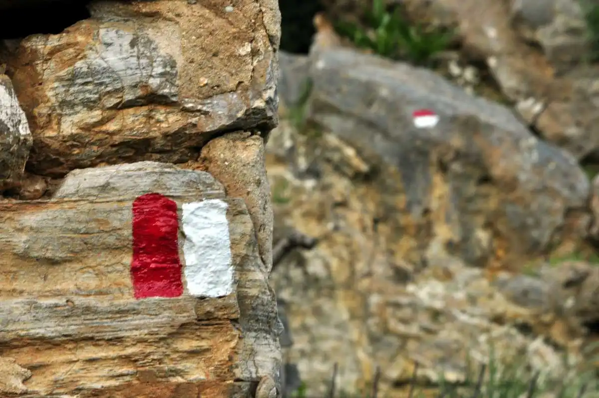
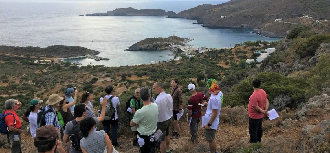
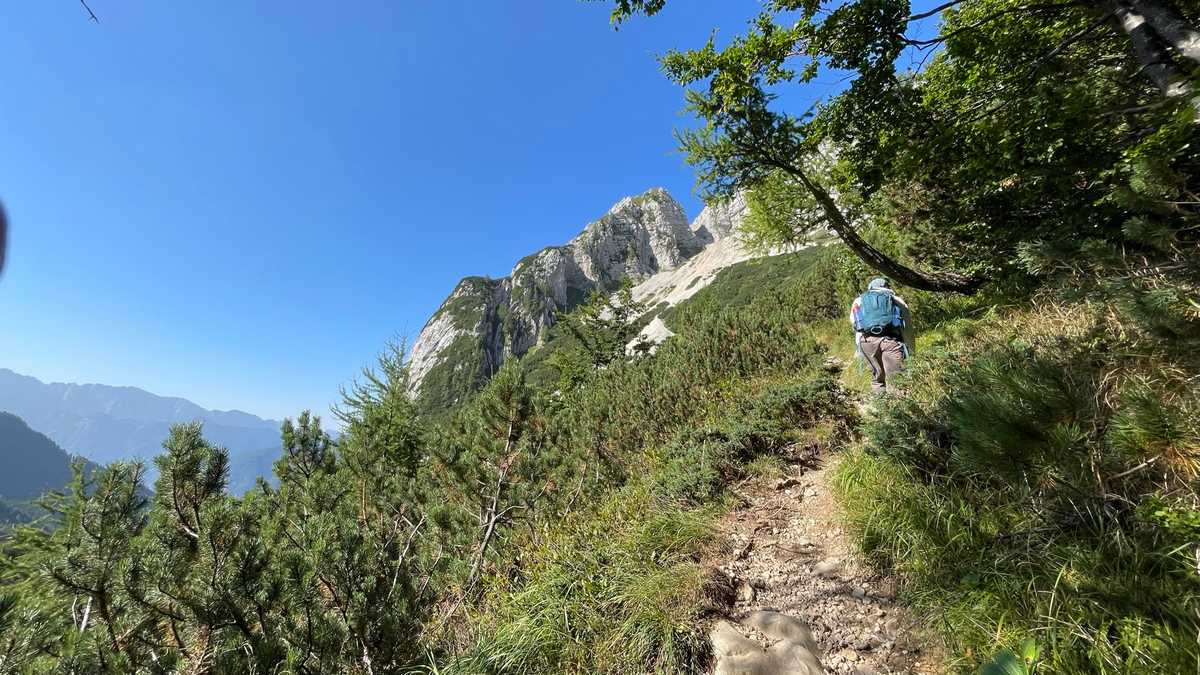
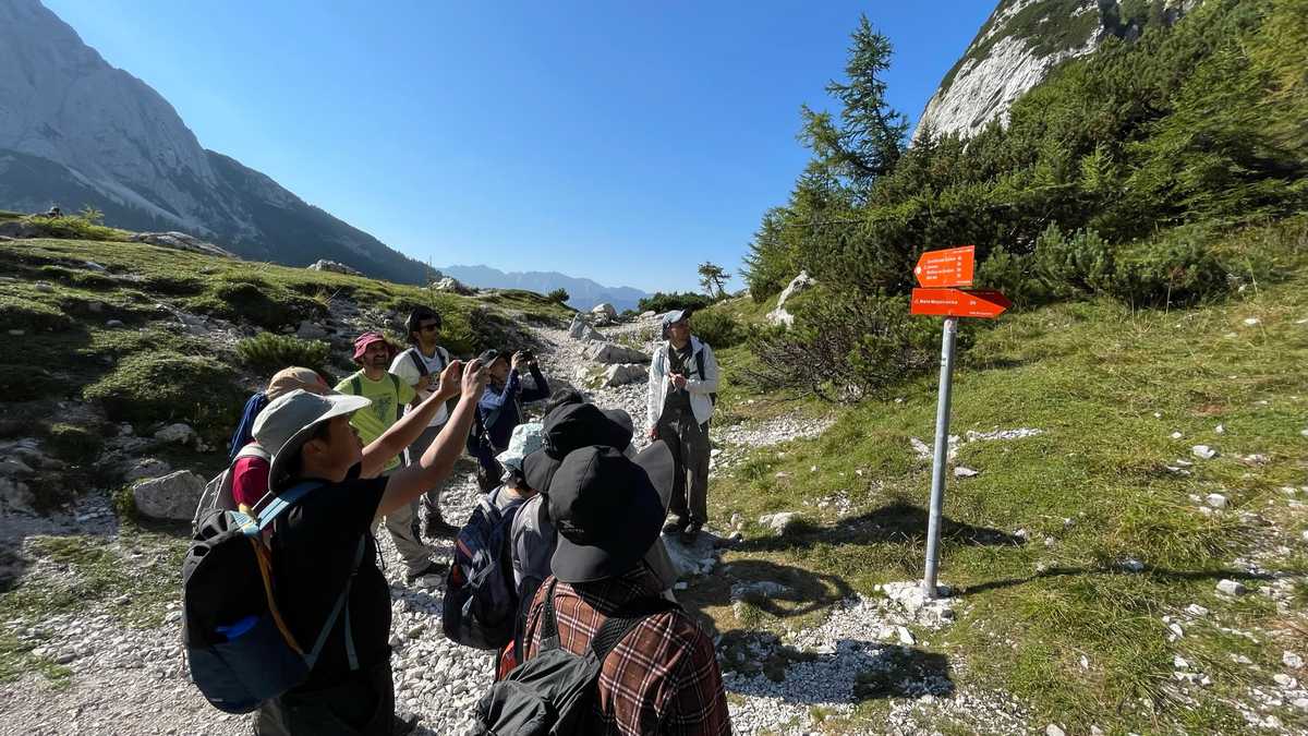
We woke up at dawn, before the first rays even lit up our hotel. Our departure with the vans was immediate after our breakfast. The goal was Slovenia’s only national park, the famous Triglav in the Julian Alps. There, we had the opportunity to reach the alpine zone and see up close the waymarking of the national network of trails managed by the Federation and the local clubs.

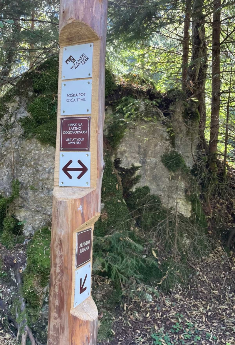
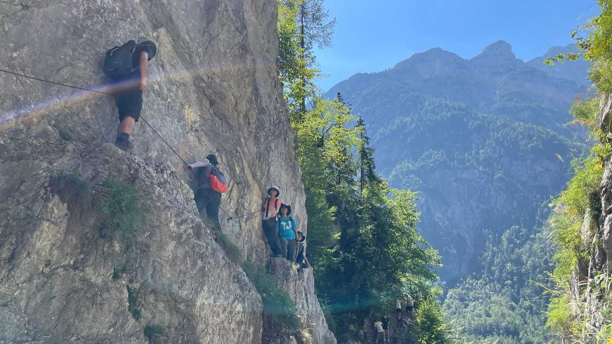
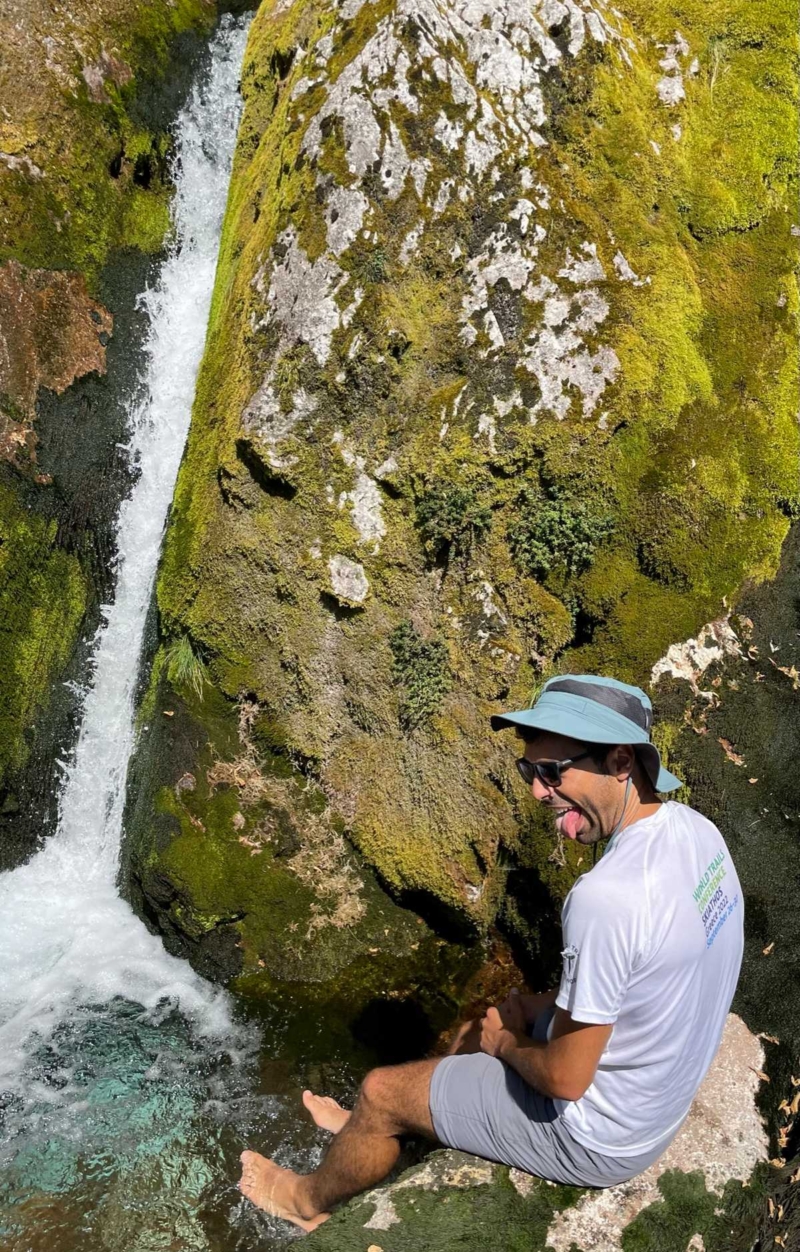
After a short hike, we continued with the vans to a lower elevation of the park, and walked a fairly exposed path that leads to a source of the Soca River.

There, Constantine dared to put his feet in the water!

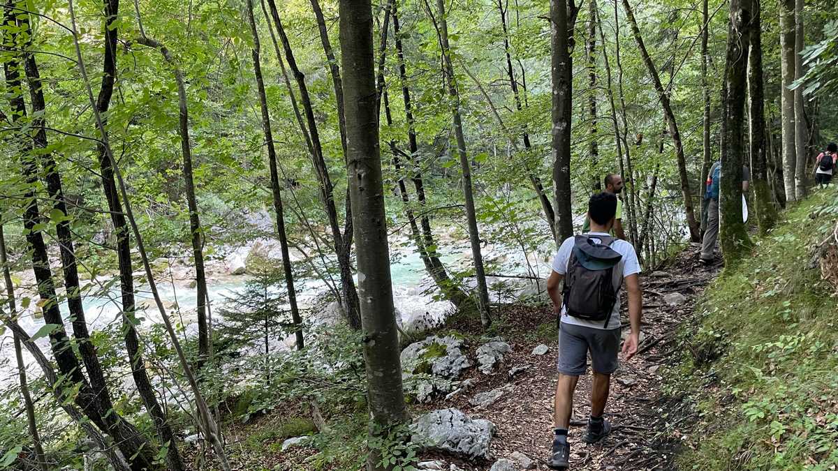
We were then guided by the park trail manager along the riverside route to the information center where we had the opportunity to enjoy a great video about the national park.

In the evening we returned to our hotel, where Morpheus came down from the Alps and met us as we entered the room.

Day 3 – Italy / Austria

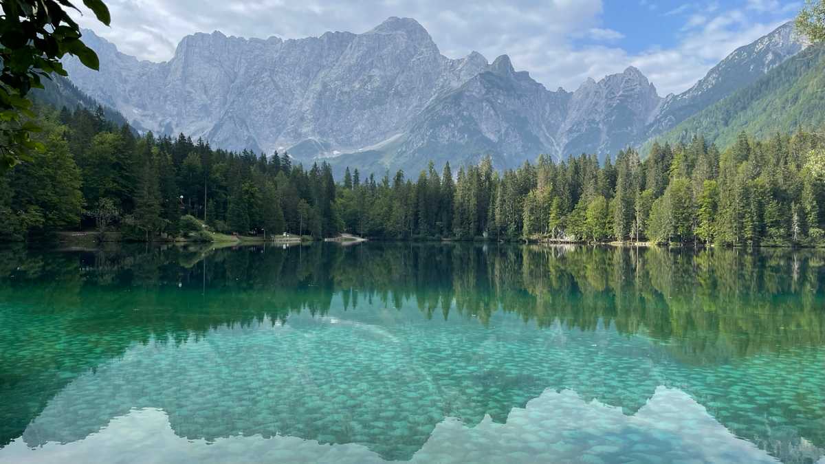
A very early morning wake up and a hurried breakfast on the schedule. And then, a short passage to Italy. It’s like we went for a coffee! We went to see the Laghi di Fusine lakes. Of course, we were left speechless by the beauty of the landscape. We walked the circular path around the lower of the two lakes, enjoying the incredible reflections of the Alps in the crystal clear waters. At this point, the Alpe – Adria Trail passes, one of the most famous long trails in the region, which connects the Alps with the sea. An Italian espresso and we left for Austria.

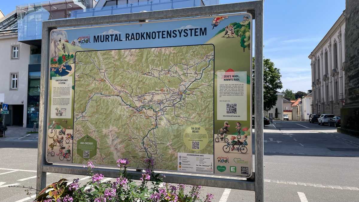
The trip to Austria took a while. Our first stop was the small town of Judenburg, where we were able to see waymarking systems for cycling routes within settlements.

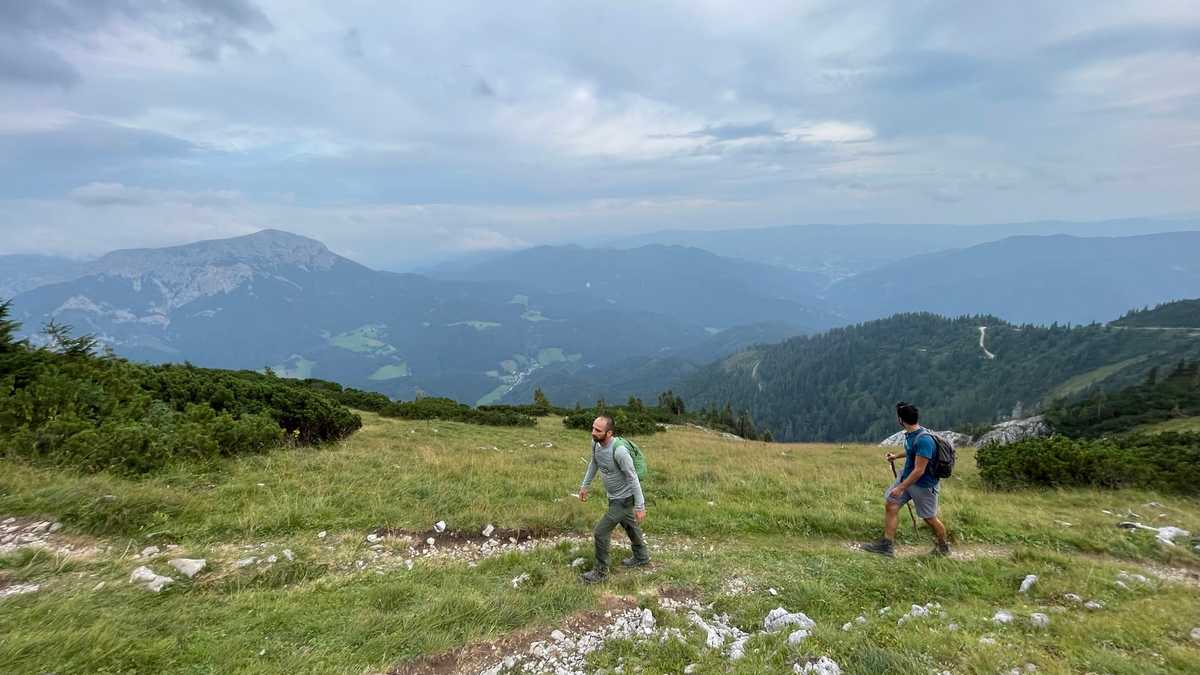
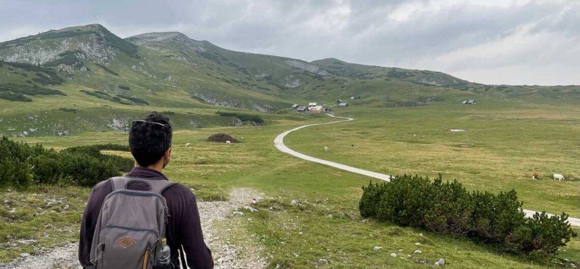
Afterwards, we made a fairly long stop for food to recover. A short way and an uphill but beautiful drive up the Schneealpe mountain awaited us where we ended up at the relatively luxurious Michlbauerhütte. A cold shower was a must after the hike! Followed by the best meal of our trip!

Day 4 – Austria

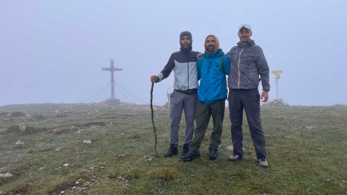
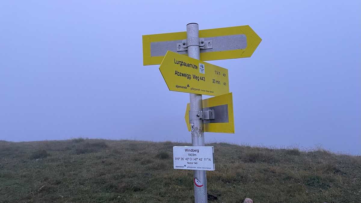
Rise at 5, hike to Windberg Peak at 5:30. In the fog. Purely masochistic. We saw nothing beyond the cross at the top, barely above 1900 meters. This was followed by breakfast at the shelter and a downhill walk to the vehicles. We had the opportunity to discuss with the Taiwan team various trail erosion issues and how they are dealing with them there. With the rain falling in their country, they will know something… as it turned out!

Then we visited a private forest, where a farming family has built a whole park with trails for disabled people and small children. At every turn of the trail, they had various toys with natural materials which excited us! The most impressive of all, of course, was a pair of grandparents, who brought their grandchildren for a hike in the forest!

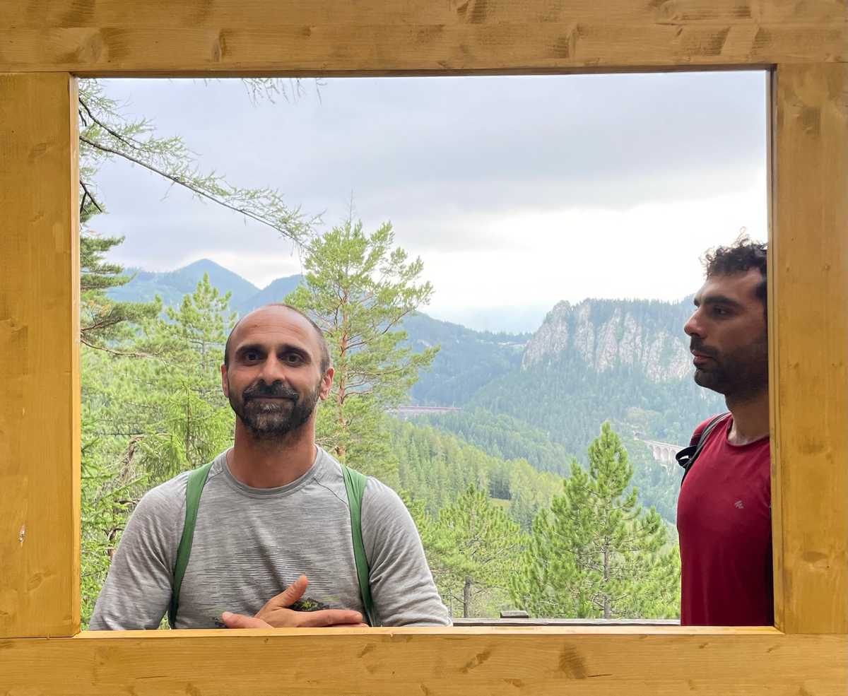
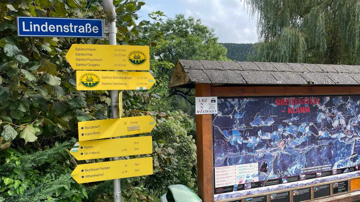
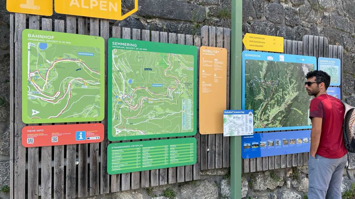
Short stop for food nearby and after a bit of driving, we arrived at the starting point of our next hike. The starting and ending point is Semmering train station. And the hike began by train to the next stop, Breitenstein. From there, we walked a path parallel to the train tracks, to return to Semmering.

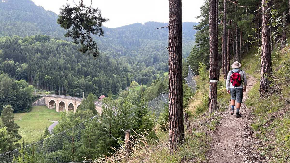
This path is part of a long route, along the oldest train line of the Alps which is also a UNESCO monument. Of course, the show was stolen by the arched bridges, built about 150 years ago… Here we should note that despite the signage, without the application of Outdooractive we would definitely get lost…

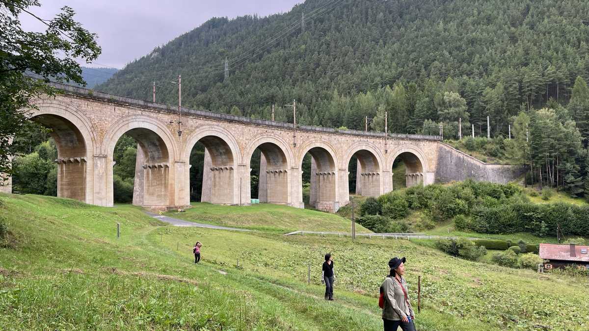
Our four-hour hike ended at a restaurant in Semmering just before heavy rain hit. At the dinner we also met the tourism representative of the Semmering area. From there, after about two hours’ journey, we arrived in Hungary, in the city of Fertod, old capital of the Esterhazy fiefdom, where we slept dry.

Day 5 – Hungary

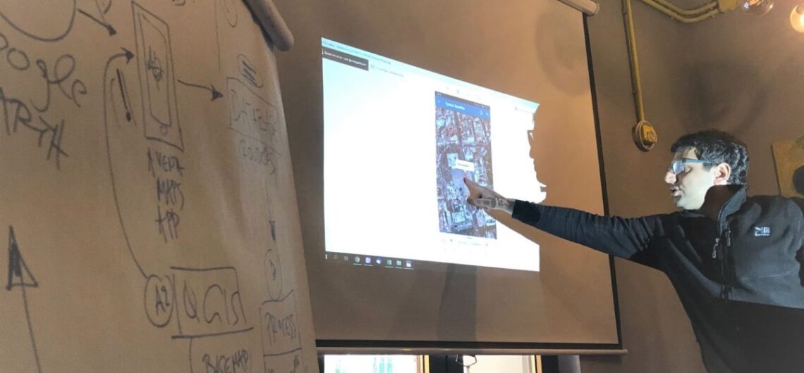
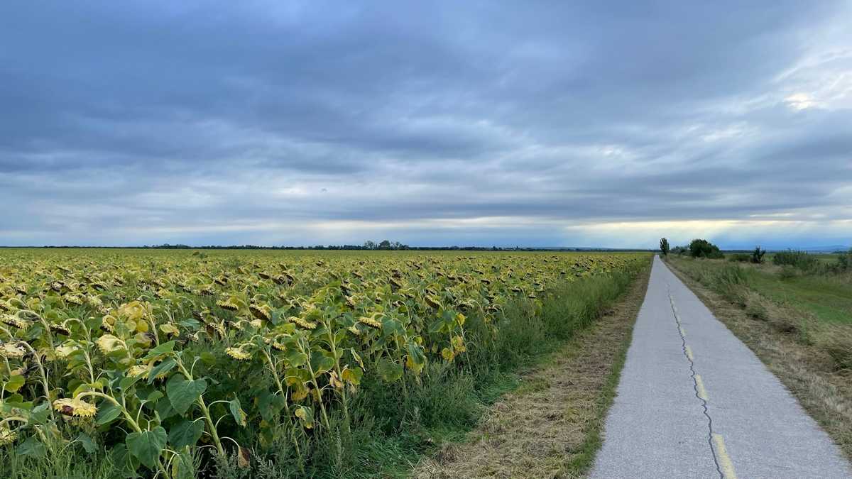
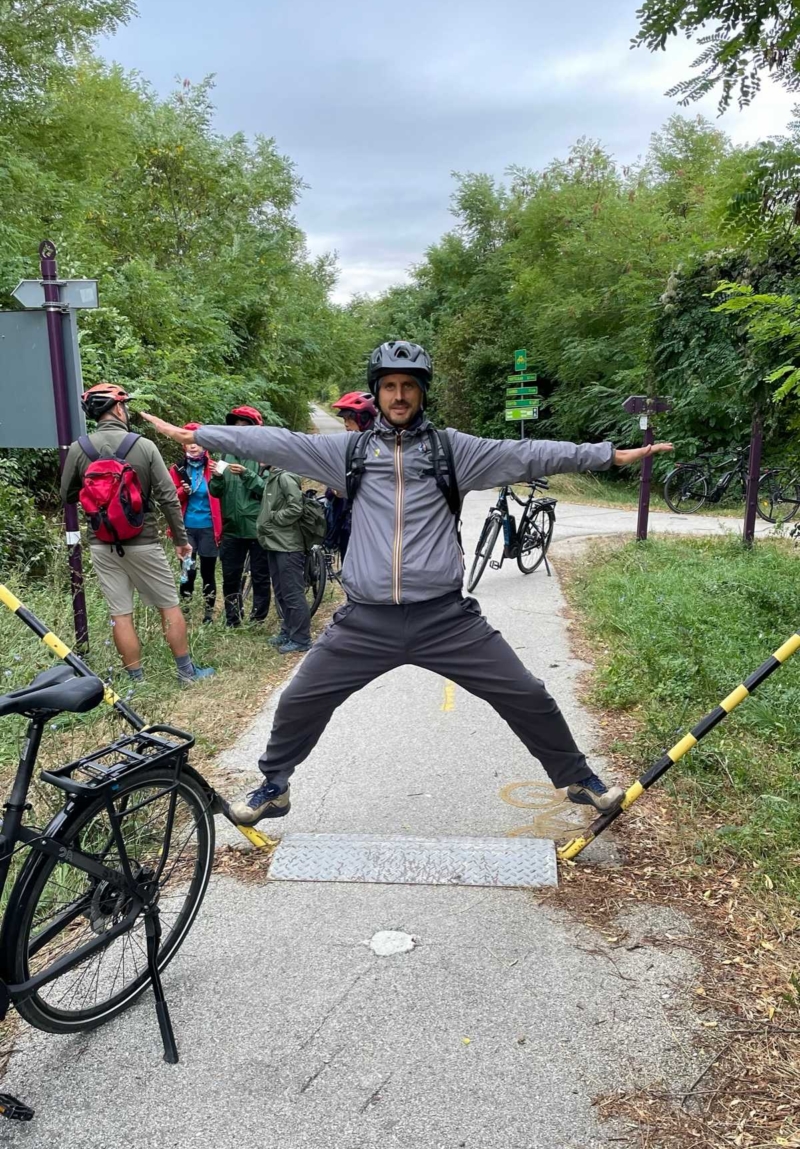
Relaxed awakening today at 8:00! Breakfast at the hotel and then we had a work meeting, where we discussed what we saw in the previous days, what impressed us and what troubled us. The conclusions are described below. In the afternoon we had a nice bike ride in Fertő-Hanság International Park.

With the bikes we also passed through Austria, where the “Iron Curtain” used to be. Now, with one wheel Hungary and with the other Austria, without borders, controls, customs, etc.

Day 6 – Hungary

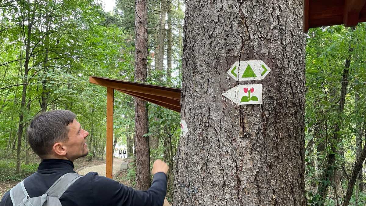
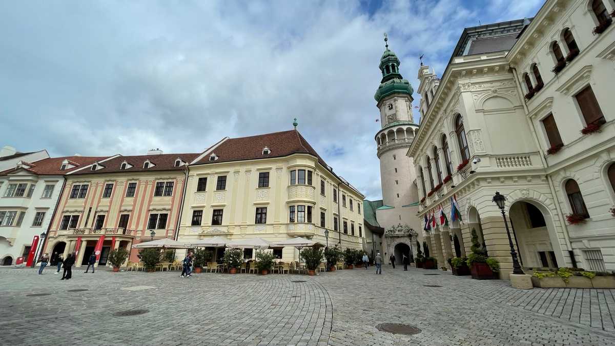
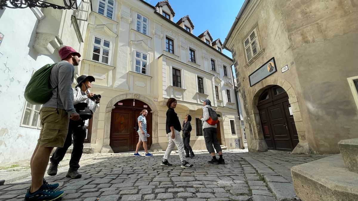
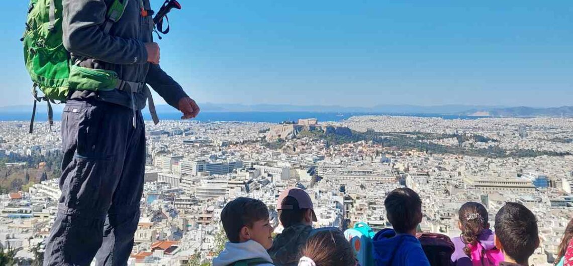
After breakfast, we went to the nearby town of Sopron, where we walked peri-urban routes, saw the markings they use on Hungarian trails and admired the city from above. We also walked along a path for disabled in the Sopron grove.

Then, we toured the streets of the city, also seeing the ruins of the Roman fortification that was there. In the afternoon, from our hotel in Fertod we participated online in the international meeting of the World Trails Network and the Trailology program. There we also presented the marking system that we have invented and that we use in most of our projects.

Day 7 – Slovakia and departure

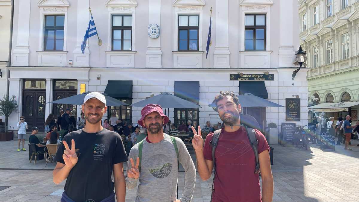
After our breakfast, we packed up and drove to Bratislava, the capital of Slovakia, which is literally on the border with Austria.

After a short but impressive tour of the city along the Danube, we arrived at the Vienna airport from where we departed for Athens.

Conclusions

This trip was particularly enlightening in the matters of waymarking and route formation in general. We saw systems they use in 4 countries, in different landscapes (mountain, plain, rivers, lakes, etc.). We saw markings for walking and cycling routes. We also saw routes for the disabled and for children. Finally, we even saw cross-border routes where you hardly realize that you are changing countries!

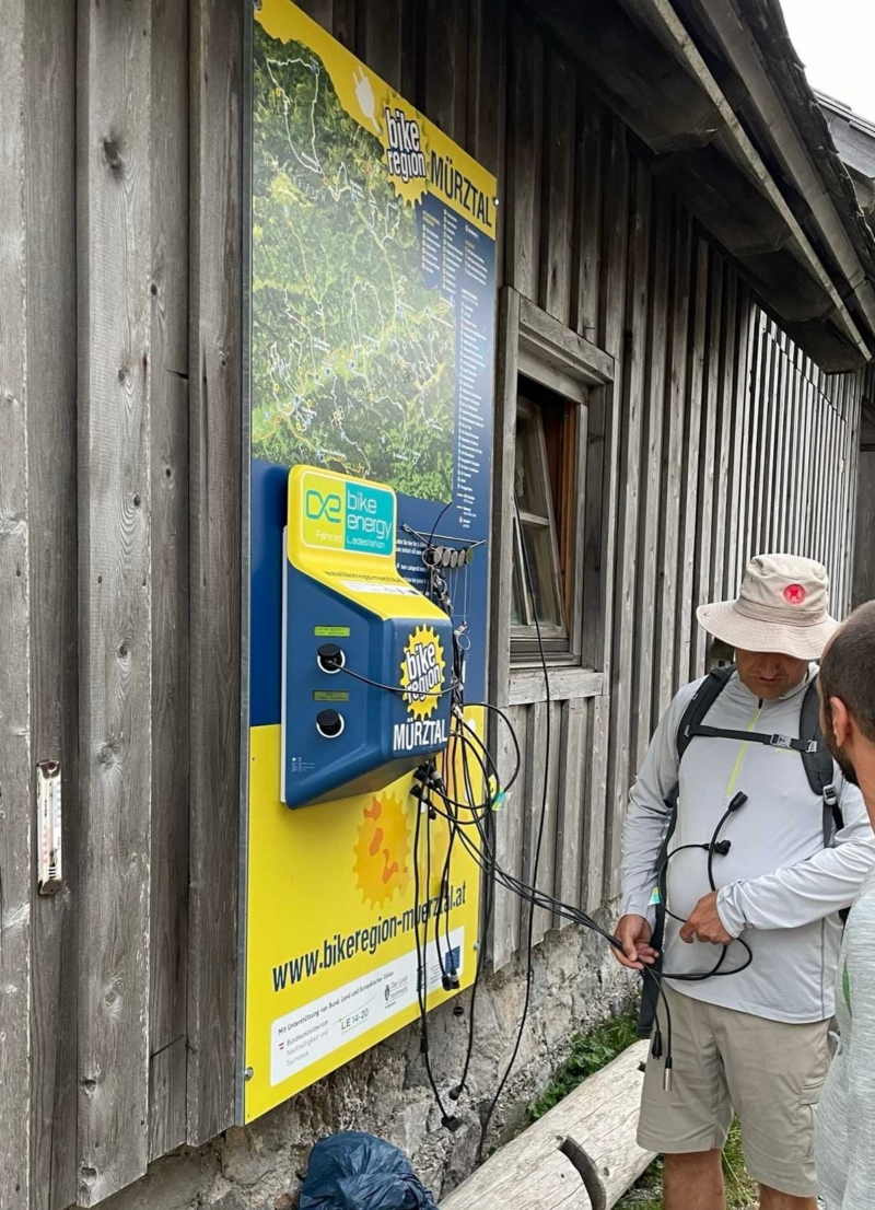
There were many people walking on the trails. Of all ages. In all the countries we passed through. Of course, most of the routes had car parks, and we often saw e-bike charging stations. Even in mountain shelters.

The use of natural materials was also very evident throughout the trails. However, we did not see a particular effort to manage erosion, which in some parts of the route was particularly important.

We also met and discussed with decision makers in these countries about route management, signage and visibility.

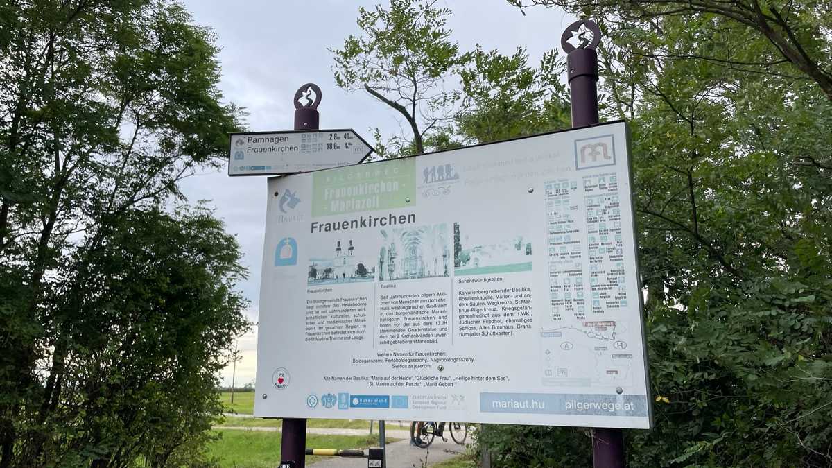
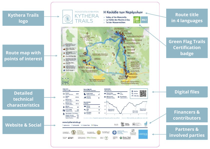
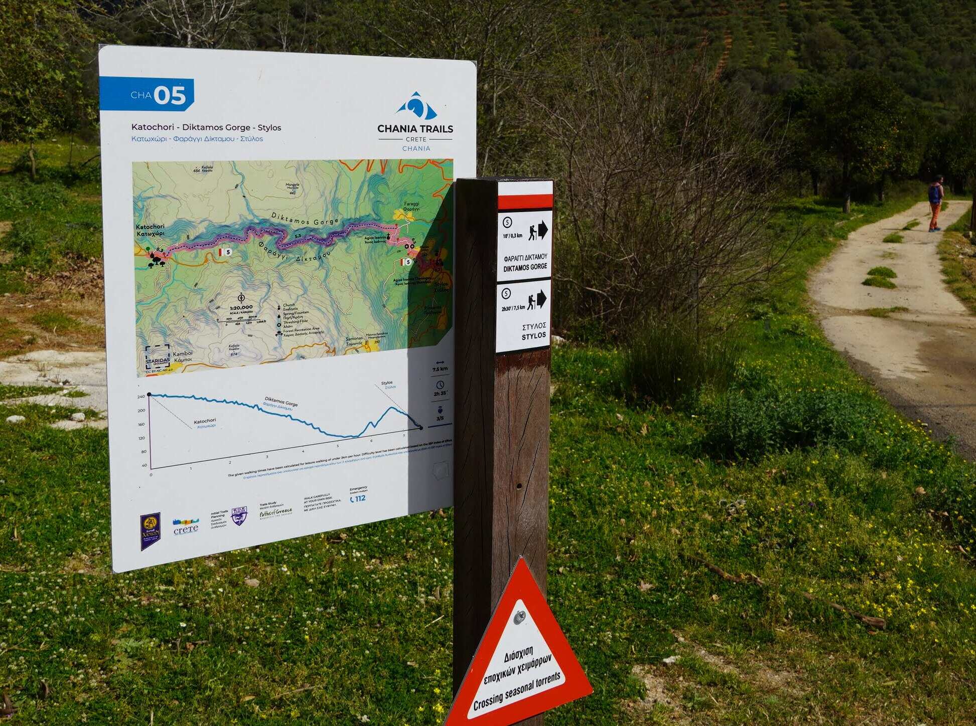
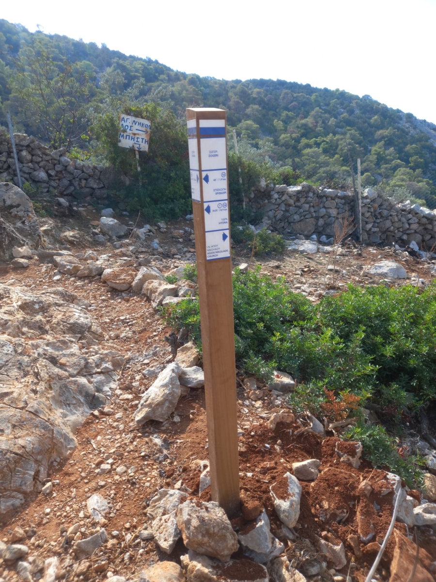
Overall, we were not entirely satisfied with the signage we saw on our trip. Initially, it had many “gaps”. That is, points where either there was no marking or the existing marking was not clear. In other places, we believe that the signage caused more visual nuisance than it should have. Also, almost all the signs were monolingual, meaning they had no English, even if they had descriptions. Finally, in a few cases we found clear entry signs along the route, with a map, technical characteristics, etc.

We also saw few circular routes but at the same time a great demand from the public for circular routes and in the discussions we had it was evident the recognition that most people are looking for short day hikes rather than long routes.

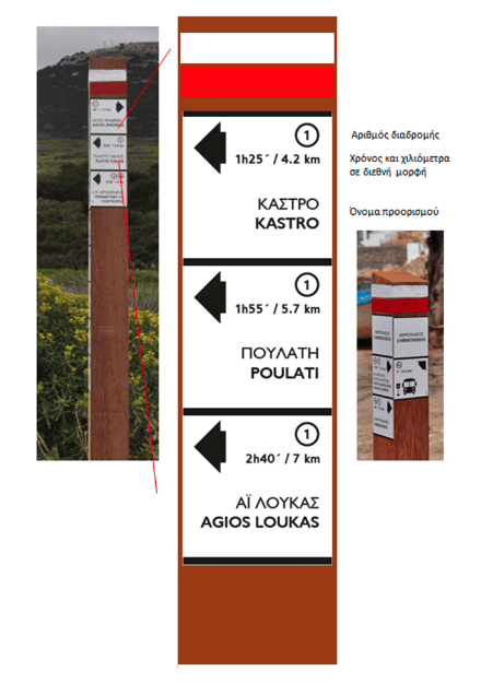
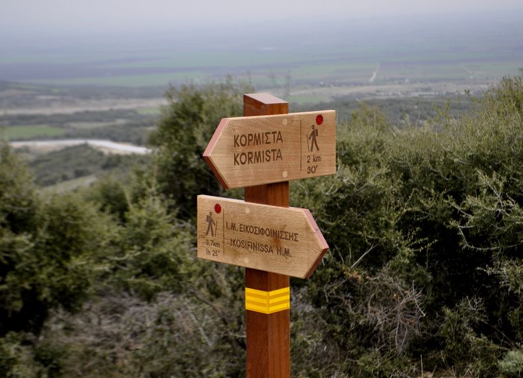
Judging by our own signage system, we consider it to a great extent to satisfy the requirements of a perfect signage, with lower cost, greater durability and less visual nuisance. To improve it, based on what we saw – and mainly the Hungarian marking system – we decided that when marking with color, where routes intersect, we will also mark the number (code) of the route, so that even if the stake with the directions, so the hiker can follow the right path.

The planning of the routes we do, with an emphasis on daily routes, we believe opens up the world of hiking (and cycling) to the widest possible range of population. Long multi-day crossings are also good, but can come as the culmination of a network of local routes. Here we should add to the advantages of local networks that they strengthen the economy better as they pass through more settlements and at the same time give access to many more points of interest, giving at the same time a reason for their maintenance and promotion.

On the occasion of our trip, we decided to soon organize a similar trip to Greece, studying the various systems that have been used, and of course analyzing the current legislation on trail markings.


Marking paths with entry signs


Marking with entry signs is required for all trails. These signs are used at the entry of each route, in locations such as town squares. They can improve the experience of hikers as well as attract new inexperienced people.

Contents of entry signs

Trail entry signs must provide all useful trail information, including:

  • length,,
  • time,
  • degree of technical difficulty,
  • effort intensity,
  • sense of risk,
  • max/min altitude,
  • total ascent/descent and more.

This allows hikers to fully understand whether the route meets their needs.

In addition, trail entry signs act as promotional material for the hiking network. Through these signs, it is likely to attract even people who had no intention of hiking. They provide information and encourage visitors to discover the beauty of the trails.

Arrangement of entrance signs

Entry signs are mounted on trail directional sign posts and are divided into 4 parts.

  • At the top is the code and name of the route.
  • The central section shows the map of the route, which is the result of specializedcartographic/graphic editing.
  • At the bottom are the basic characteristics of the routes, such as distance and degree of difficulty. In addition, there are QR codes that allow users to download route files to their mobile phones.
  • The partners, contributors and supporters of the program are listed in the lower part.

Product quality

With durability and aesthetics in mind, we use signs made from durable stratimage material, which guarantees unaltered quality for a decade. Alternatively, solid aluminum, at least 3mm thick, can be used. The signs are usually supported on stakes made of recycled plastic.

At Paths of Greece we work exclusively with Staridas Geography and the internationally recognized cartographer Spyros Staridas. We believe that his maps are perfect from both an aesthetic and functional standpoint.

Placement of entry signs

Trail entry signs are mounted on stakes or trail directional signs. They are fixed on the stakes by screwing them on with nuts, at the back side of the stake. This process is carried out in such a way that the visibility of the direction sign is not affected.

If you are interested in the development and marking of paths in your area, you can contact us to discuss the best solutions. We will be happy to help you with the planning and implementation of the paths and the corresponding signage. Let’s promote together the exploration of nature and the enjoyment of the hiking network in your area.

See more examples of our projects

Trail directional signs


The signage we use at Paths of Greece can be divided into three main parts:

  • marking with colour, which indicates the direction of the route. We have mentioned it in previous blogs.
  • marking with directional stakes and
  • information signs.

In this article we will refer to trail directional signs.

Contents of directional signs

The marking with direction signs is done at the starting points of the route and at the main intersections. It aims to determine the position of the hiker.

It includes information such as:

  • the point or settlement to which each leg of the route is directed to (intermediate and final destination),
  • the distance in kilometers,
  • the estimated time required for hikers to reach the destination and finally,
  • the route code.

Also, the direction signs can contain the toponym of the specific point, indications of dangers, altitude, etc.

Such information is necessary to enable hikers to do their own planning. This of course depends on the strength and appetite of each person. Additionally, this information provides a greater sense of security.

Advantages of directional signs

At Paths of Greece, with international experience and know-how, we have marked many kilometers of trails. Thus, we have seen and tested many marking systems.
We have concluded that the best way to mark Greece’s hiking trails is a marking system with four-sided stakes. Signs with indications of destinations, distances, times and directions are screwed to their sides.

We choose this method as opposed to traditional signs that have only one side of a large size, because we believe that with four sides we gain a multitude of advantages:

  •   Because of the four sides it can hold more information than on one side.
  •   The four sides allow a better indication of the direction of the route. The combination of the side and the arrow can indicate the exact course.
  •   The information is shared on many sides and thus we avoid visual oversaturation. Each side has specific information, making it easy to read.
  •   Less intrusive than the bulky signs commonly used.
  •   Greater resistance to corrosion due to small size. Large protruding signs are more affected by natural phenomena.
  •   They are a combination of functionality, simplicity and aesthetics.
  •   Its small size results in lower costs and greater ease of installation and correction.

Trail directional sign material

Another important aspect of marking stakes is the material used. Now, instead of wood, we use 100% recycled (and recyclable) plastic. These materials are compressed and take a form largely similar to that of wood.

The positives of recycled plastic are many and important. For example, the longevity of the material is longer, as it does not corrode like wood. At the same time, its elasticity allows it to deform and return to its original form under great pressure. Equally important is the greater resistance to fire effects than wood.

Of course, among the positives is the great environmental impact, as well as the awareness of the population regarding new alternative technologies that deal with the modern problem of uncontrolled pollution and reckless consumerism.

Installation of direction signs

The sign posts are installed with the longevity of the sign in mind and the prevention of vandalism. At the same time, an effort is made for as little intervention as possible in the natural environment.

The installation process begins with digging a pit, approximately 0.5m – 1m deep, depending on the height of the stake itself.

Then, an iron rod is wedged vertically at the base of the pile, in order to stabilize it.

The stake is placed in the hole and the space around it is gradually filled with cement and stones.

The cement stops about 5 cm below the soil surface and the filling continues with soil.

Depending on the individual circumstances, a stake may not be driven into the ground, but placed on a surface, such as a wall or a terrace, by using studs.

Of course, no method is absolute and optimal. We believe that improvement comes through dialogue and exchange of views.

So comments and suggestions are welcome!

Interested in trail development and signage in your area?

Contact us to discuss the best solutions.

Examples of hiking networks

Want to see an example of path direction signs made by Paths of Greece?
See the paths of Poros and Kythera up close!


See photos of our previous projects

Educational program: “Exploring the hill of Lycabettus”


On March 30, the first step was taken in a plan that had started before the appearance of Covid-19 in our lives.

That is the educational program: “Exploring the hill of Lycabettus” that we developed, in collaboration with teachers, through which we aim to bring children into contact with the natural environment, using experiential and interactive activities.

The general objective of this educational scenario is to offer students opportunities to acquire knowledge and develop skills, values and mindsets that will allow them to observe, describe and interpret the natural environment, as well as its relationship with the anthropogenic, through the hike.

In addition, one of the main objectives is to cultivate the perception that hiking is not just a physical exercise, but also an opportunity for meaningful contact with their surrounding nature and culture. With this activity, the children get to know and walk along some of the already existing walking routes of their city and explore their special characteristics.

Also, the children will learn what a trail is, where we find trails and what the degree of difficulty of a trail depends on. What is a hiker’s gear and why is it necessary. What is the language used by hikers, through the signs they use, and how this language transcends the borders of countries, since from a common code of signs, people who speak different languages can understand the route of a trail.

So, on the morning of Thursday, March 30, the children of the 1st Primary School of Neo Psychiko walked a circular route on the hill, which they mapped, took photos and noted its points of interest.

They learned to distinguish the marking of the paths and the reasons why its presence is necessary.

At the same time they explored nature, noticed its contrast with the city, wondered about human intervention and heard about the history of the area.

They understood that hiking is not only walking, but contact and love with the nature that surrounds us!

Of course, along with the children,  their teachers also enjoyed the trip! After all, hiking is a “sport”, truly for everyone.

We hope that these kinds of experiences will follow the children as they grow up, and will be the trigger for their own journey on the paths of the world.


Trail waymarking materials


After having examined the technical characteristics of waymarks, let’s see what are the waymarking materials that we suggest.

In the beginning, at Paths of Greece we used aluminum signs, colored with the silk print method.  Their dimensions were 6,5 x 13 x 0,2cm. We used inox screws to screw them on rocks and trees. We soon realised that this was not the optimal technique for the following reasons:

  • The aluminum signs have a specific size and this does not allow their adaptation on every surface.
  • Screwing on rocks is a permanent alteration of the natural landscape
  • Silk prints are not very durable in outdoor conditions, especially when colours are light.

For the above reasons, and after doing a thorough research for good practice abroad, we came to the conclusion that waymarking with the use of colour (paint) is the best.

Waymarking with paint:

  • Adapts to every surface
  • Can take any dimension
  • It is not a permanent alteration as it can be removed or faint with weather
  • It is easy to use and install as often as needed (especially when dense waymarking is needed)

The material we use is A quality shiny car paint. It is a 3-component colour (with thickener and dissolver), thick and dense, that only requires two layers when applied. This paint is very visible, whether it is used on rock, wood, metal or any other surface.

We apply it with small brushes, and take it from small 30ml jars, where the paint is mixed with the thickener and dissolver. We use such small jars because otherwise the colour will dry and be useless. Car paint can be applied only on dry surfaces. However, if it rains right after the application, nothing happens to it. It cannot though be applied on wet surfaces.

In some cases we still use aluminum signs, especially if we want to emphasize on waymarking. These have the following specs:

  • Dimensions 6,5 x 13 x 0,2cm
  • Aluminum with UV protected vinyl
  • They are being placed on rocks and trees with the use of high elasticity and strength silicon glue

The above come from the experience of Paths of Greece in sign-posting and waymarking thousands of kilometers of hiking trails, and many international travels that we have had around the world, looking for the best practices. We would also like to mention that waymarking with paint is used in most European countries like France, Switzerland, Germany, Spain, Portugal etc.

Trail Waymarking


What is considered to be a good waymarking?

The answer is one: “Waymarks that a hiker can easily understand and seamlessly follow”.
In this article series we will attempt to present the thematic of trail signage with examples and pictures.
In this article we will speak about waymarking with paint or small signs, that only indicates direction.
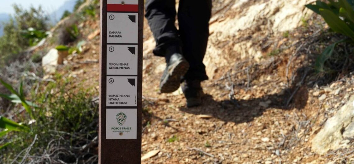
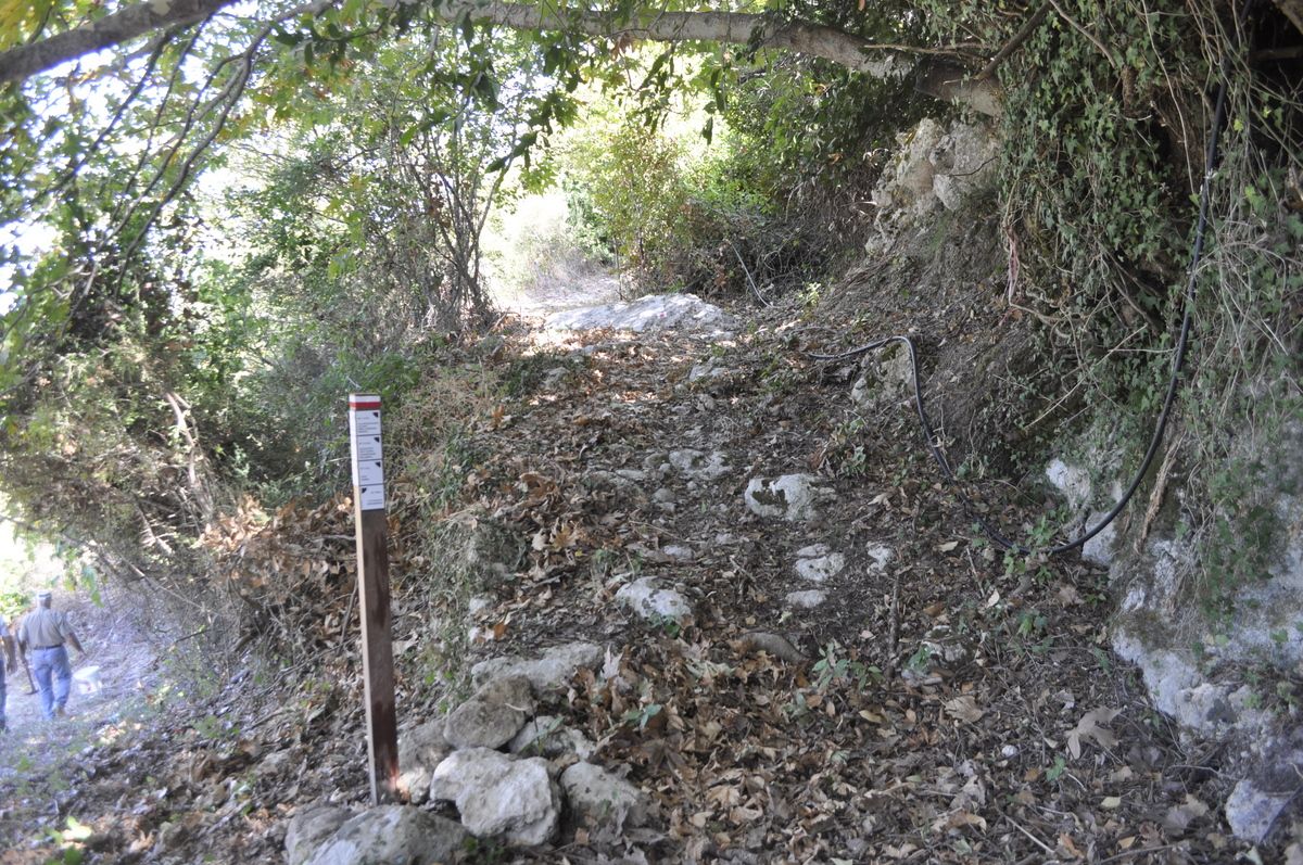
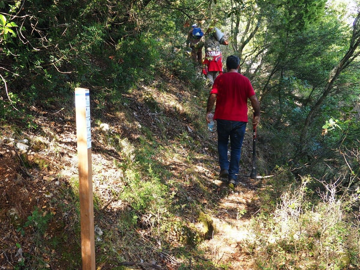
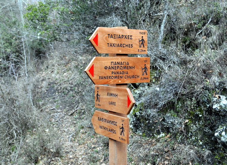
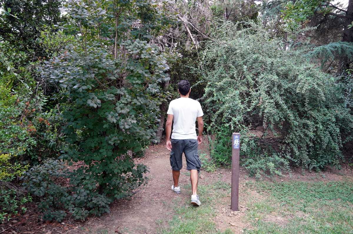
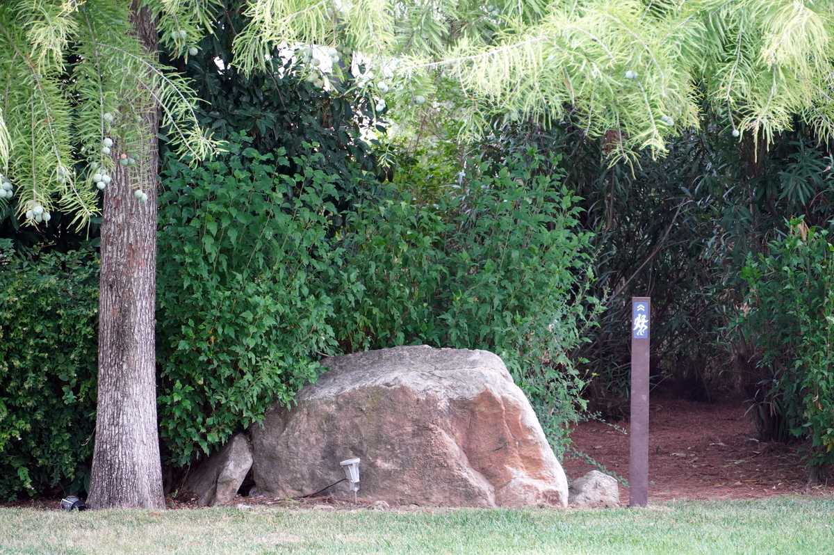
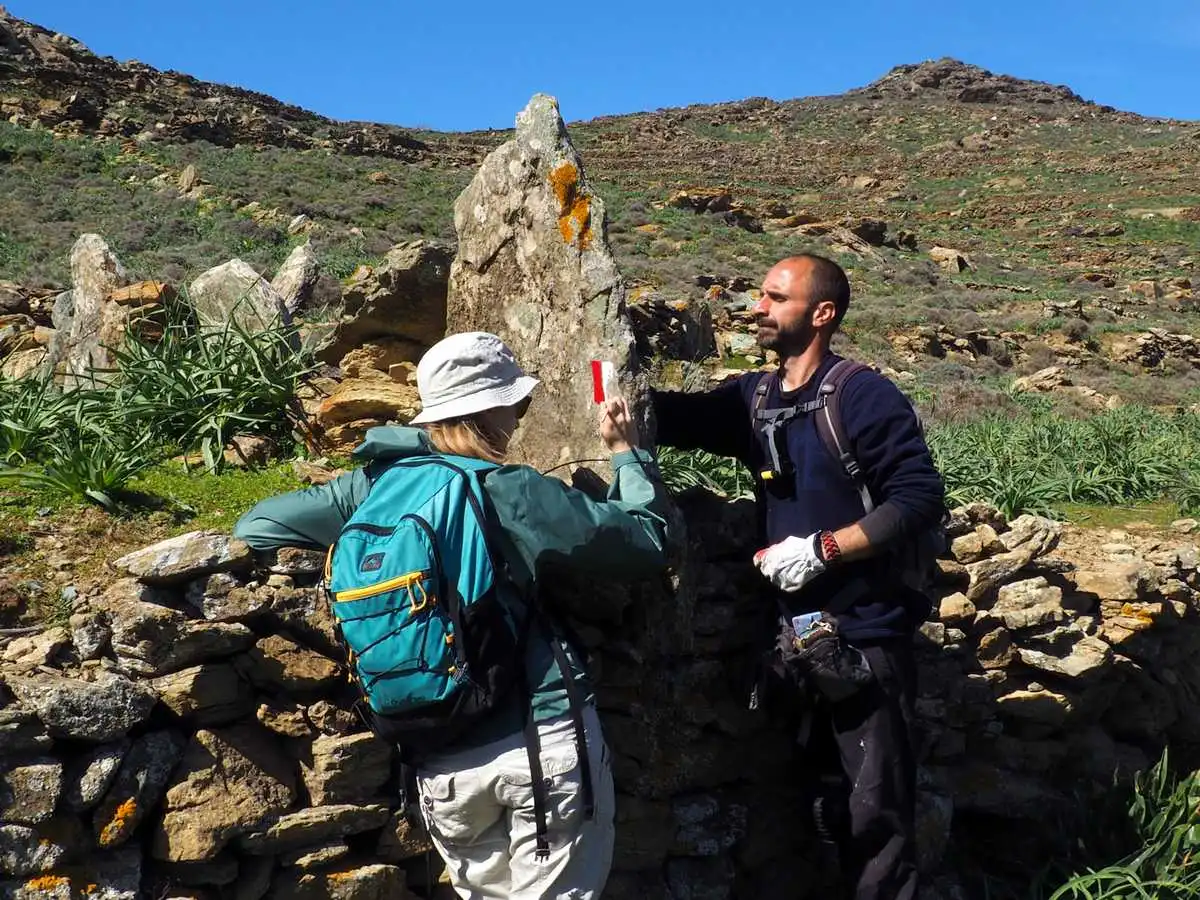
Waymarks are placed in such a way that they cannot be seen from hikers walking in opposite directions.
Waymarking aims at guiding hikers in a precise way, making them feel safe during the walk. Independently of the type of material that will be used, the way to put signs must follow some basic rules:
 
  1. Frequency
    It needs to be installed as often as needed (for example, in places where the trail is not visible, you should be able to see at least one sign from another. On the other hand, when the trail is very visible and there are no junctions, the distance between signs can be up to 250 meters.
  2. Visibility
    It needs to be installed in such a way so that the sign of one direction is not visible from those walking in the opposite direction (wherever this is possible)
  3. Height
    The signs should be installed at eye height (where possible), and in line with the hiker’s movement.
  4. Contrast
    Signs need to be composed of at least two colours, one lighter and one darker, so that contrast is created independently of the surface of application.
  5. Shape
    The arrow (if any) needs to be clearly pointing toward the trail.
  6. Respect
    Painting or sign installation must be performed with extra attention and care about the environment and culture.

One sign is visible from another.

Using one set of colours on a network of trails is also considered to be best practice as it helps hikers recognise the trail network.

Painting must be done with much care

Paths of Greece has an extensive experience in waymarking, and it uses a specific system for waymarking, presented here below:

The two lines are coloured in parallel to the trail line, so that they give a directional information. White always gets on the side of the trail.
Arrows indicate a change of direction and should be visible only from the direction that they concern.

The curve is coloured only on the ground, it follows the curvature of the trail and indicates a change in direction. It is visible from both directions on the trail. It is used only f there is no possibility to use an arrow.

The “Χ” indicates a wrong direction and it is a particularly important sign for absent-minded hikers!

Stay tuned to read about our next article on material used for waymarking!

10 years Paths of Greece!


In 2021 the Social Cooperative Enterprise “Paths of Greece” celebrates its 10th anniversary!

We recall the experiences and emotions we experienced in this process: The emotions we felt looking for paths lost in time and the stories of the past, the stories we learned in our encounters with local people, the creative enthusiasm of building paths, but also the genuine joy that we feel when we hear compliments about our work from hikers. All this gives us strength to continue with even greater passion and determination!

In the past 10 years, we have studied, restored, sign-posted and promoted paths that we truly love. Below we mention some paths which we consider to be milestones in our journey, not because they are more important than the rest, but because they gave us the impetus to improve what we do.

Kythera Trails

Our journey with Paths of Greece started on Kythera island, at the end of 2010, where through synergies, research and a lot of volunteer work, a network of hiking trails was created with multiple benefits for the local community that every year expands and operates more efficiently. This was followed by works in Patmos, Mount Paggaio, Ymittos, Fiskardo in Kefalonia and elsewhere.

Hikers walking on one of the spectacular hiking Kythera Trails

International Trail Consulting

Paths of Greece participated in the 3rd World Trails Conference organized in South Korea in 2014 by the World Trails Network (WTN). There, the co-founder of Paths of Greece, Fivos Tsaravopoulos, was elected Treasurer of the International Board of Directors of the organization and the conditions were officially created for the transfer of our know-how outside Greece. In the following years we provided international trail consulting in ChinaJapan and Albania. Through the World Trails Network we have a strong interaction with the developments in the world of trails, having created international relationships and collaborations of special value.

From the international trail consultation in the region of Kanas, China.

Sifnos Trails

The next big stop for us was the creation of the Sifnos Trails hiking network. Sifnos for years tried – unfortunately in fragments – to become a hiking destination. In collaboration with the island’s municipality, we way-marked the trails, created an identity as well as the appropriate tools for the promotion of the network – website, application for smartphones, QR-codes, recording of routes with Google Trekker, twinning with other hiking networks in the world, dynamic presence in exhibitions and magazines abroad (France, Germany, Sweden, Poland etc.). The result was that Sifnos emerged as one of the top hiking destinations in Greece and the tourist season on the island has been extended with quality tourism.

Transporting sign-posts for the trails of Sifnos, in collaboration with the local society.

Chania Trails

In Sifnos we realized that the good cooperation between the local authorities, the local population and the specialized advisors in the development of paths brings spectacular results. The success in Sifnos was followed by our studies in various parts of Greece, from Alexandroupolis to Prespes and from Karpathos and Kasos to western Crete, where we gradually undertook to study all the paths of the Regional Unit of Chania.

We discovered forgotten mountain passes, trails in fairytale forests, Roman roads, and especially areas of infinite natural beauty and exceptional cultural wealth, to which the average interested walker unfortunately did not have access. The network we are planning in western Crete, with the valuable cooperation of the regional and local authorities as well as the local community, will exceed 600 kilometers in length. Its operation and maintenance will also be based on the tight cooperation of local authorities and the local community.

The moment of discovery of an ancient Roman road near Sougia, in Chania, Crete.

Hikers’ Friendly

In 2018 Paths of Greece launched the Hikers’ Friendly Accommodation Certification, a guide, in essence, advising hotels across the country in an effort to upgrade their facilities and services so that they can meet the requirements of the hiking community. Through our contact with local communities all over Greece, we promote the investment in the Hikers’ Friendly model. It is an important step that the hosting sector should take, especially in the post-Covid-19 era, if it aims at becoming a driving force for the lengthening of the tourist season, increase of revenues, and greater awareness of the rich natural and cultural heritage of the country. Hikers Friendly certification is entering a new era in 2021, adapting to the needs of the market.

Trail Certification

The organization in October 2019, in Kythira island, of the first seminar in Europe for the training of auditors of the “Green Flag Trails”, a World Trails Network certification, was another very important station for us. The certification Kythera Trails received during the seminar was a recognition of international prestige for the quality of the work of Paths of Greece on the island.

Collaborations

All these years we have built excellent collaborations on a solid foundation, on the main axis of mutual trust and respect for the experience and skills of each partner. Our goal has always been   to provide the most complete, specialized and innovative services. Among the collaborations we honor, we mention Staridas GeographyInstinct DesignKappagramStonewaveForestPlanMed-INADiadrasis and Green Life and Lysiteleia as our closest partners.

Next steps

Since our establishment in 2010, our vision has been for Greece to become one of the top hiking destinations in the world. We believe that 10 years later, our country is moving in the right direction to achieve this goal. On our tenth birthday, we decided to set as our new vision that hiking becomes part of the daily life of our fellow citizens.

In addition to getting to know our nature, culture and history that they generously offer, trails promote our good physical condition and health, with a positive impact on public health. In the years we leave behind we have experienced intensely the direct dependence of human life on nature through the effects of climate change and the pandemic. Nature sends its own messages urging us to turn toward a sustainable way of life as a necessary condition for the normalization of humanity’s relationship with the natural environment.

Thus, from 2021 we start an ambitious educational program, which aims to bring younger and older people close to the trails, to promote hiking as a way of life, to bring hikers close to the inexhaustible natural and cultural wealth of Greece and to promote sustainable, collective values ​​for a better future.

To achieve this, at Paths of Greece, we will continue our action towards creating the conditions so that every resident of our country, even in urban centers, can easily and quickly have access to walking trails.

Therefore, our new vision will be from now on

A trail near every home!

Kythera Trails becomes the 1st Green Flag certified trails in Europe


In early October 2019, trail professionals from 13 countries gathered on the island of Kythera, Greece, for the training of trail auditors using the Green Flag Trails certification led by the World Trails Network. During the 7-days long course, a selection of Kythera’s trails were audited and three of them certified as Green Flag Trails – the first ever trails in Europe to receive this certification.

Green Flag Trails is a certification that recognises trails for their accurate data, environmental responsibility and sustainable management. It focuses on sustainability and responsibility towards hiking and walking tourists and aims to stimulate ecotourism. Green Flag Trails is a scientifically based trail auditing system that has been applied and tested in 6 different countries to date, including Nepal, South Africa and Peru.

This has been the first step of the Green Flag Trails certification in Europe, the next step is meeting the demand for the certification of trails in other countries across Europe that joined the course, such as Portugal, Spain, Italy and Hungary. In addition Russia, Armenia, Georgia, Lebanon, Jordan, Palestine and Kenya are also looking to implement the system to help improve the sustainability of their trails. All the participants, who successfully attended the course, have become certified Green Flag Trails auditors.

The team of experts gathered on the island of Kythera, Greece, in order to participate at the Green Flag Trails Auditor Training Course, hosted by the World Trails Network, with the support of the Kytherian Foundation for Culture and Development and in cooperation with Paths of Greece. It took place at the Hikers Friendly certified hotel “Porto Delfino”.

Trail design, mapping & sign-posting workshop in Tirana

Paths of Greece and Mr. Spyros Staridas (Staridas Geography) had been invited by the inspired team of Tirana Ekspres, in Albania for a workshop. The scope of the visit was a seminar about the use of GIS software, trail mapping and sign-posting preparations. The Tirana Ekspres team is developing a hikng trail around Tirana in order to help the city’s visitors to discover the natural beauty and the surrounding villages of the albanian Capital.

The 4-days-long seminar focused on the use of open source mapping software like QGIS, on the use of applications to collect field data about trails and points of interest, as well as about the design and development of adequate signage. Ideas and guidelines about trail promotion where also given to the participants.

The capacity building through the seminar was very successful and we are looking forward to hiking the trail once it is open!