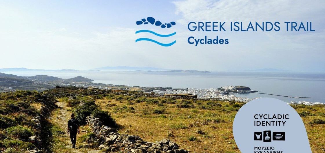
The Greek Islands Trail is a long-distance trail made up of the best trails of each of the Cyclades islands. It’s a years-long dream coming to fruition. A path that will pass through all the Cyclades and that will be the most important long route in the country. As Greece is known abroad with white and blue
Interviewing the member of Paths of Greece, Antonis Panou, about the maintainance of hiking paths Antonis Panou is a member of Paths of Greece and specializes in waymarking and maintaining hiking paths. He has been part of our team for about 5 years and has traveled all over Greece in order to implement hiking
Trail Waymarking by Paths of Greece As mentioned in the previous posts, the trail waymarking we use in our hiking networks can be divided into the following categories. Direction waymarking by color Direction waymarking with color, is done by applying color to suitable surfaces within the route and follows a specific typology. Its purpose
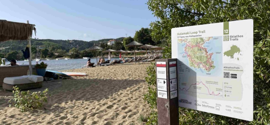
Marking of footpaths with central signs Central trail signs are large in size and act as a summary, presentation and promotion of an area’s hiking and cycling network. They are placed in central, high-traffic areas and are intended to make the hiking experience more accessible for visitors. Contents of central signs The main theme
Marking paths with entry signs Marking with entry signs is required for all trails. These signs are used at the entry of each route, in locations such as town squares. They can improve the experience of hikers as well as attract new inexperienced people. Contents of entry signs Trail entry signs must provide all useful
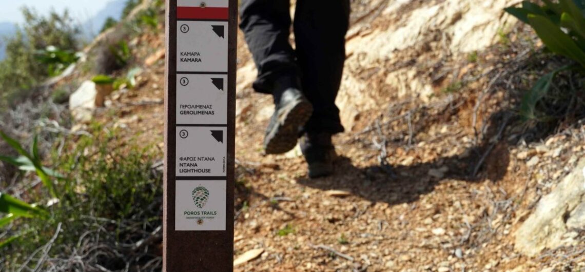
Trail directional signs The signage we use at Paths of Greece can be divided into three main parts: marking with colour, which indicates the direction of the route. We have mentioned it in previous blogs. marking with directional stakes and information signs. In this article we will refer to trail directional signs. Contents of directional
[fusion_builder_container hundred_percent=”no” hundred_percent_height=”no” hundred_percent_height_scroll=”no” hundred_percent_height_center_content=”yes” equal_height_columns=”no” menu_anchor=”” hide_on_mobile=”small-visibility,medium-visibility,large-visibility” class=”” id=”” background_color=”” background_image=”” background_position=”center center” background_repeat=”no-repeat” fade=”no” background_parallax=”none” enable_mobile=”no” parallax_speed=”0.3″ video_mp4=”” video_webm=”” video_ogv=”” video_url=”” video_aspect_ratio=”16:9″ video_loop=”yes” video_mute=”yes” video_preview_image=”” border_color=”” border_style=”solid” margin_top=”” margin_bottom=”” padding_top=”” padding_right=”” padding_bottom=”” padding_left=”” type=”legacy”][fusion_builder_row][fusion_builder_column type=”1_1″ layout=”1_1″ spacing=”” center_content=”no” link=”” target=”_self” min_height=”” hide_on_mobile=”small-visibility,medium-visibility,large-visibility” class=”” id=”” background_color=”” background_image=”” background_position=”left top” background_repeat=”no-repeat” hover_type=”none” border_color=”” border_style=”solid” border_position=”all”
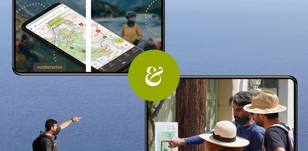
Partnership with Outdooractive In February 2023, our collaboration with the global platform outdooractive.DACH, which specializes in all types of adventure tourism, officially began. We came into contact during the World Trails Network Conference, which took place in Skiathos in the summer of 2022, with the aim of contributing to the accurate and detailed depiction of Greek
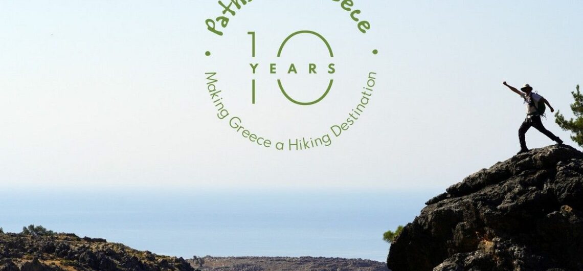
10 years Paths of Greece! In 2021 the Social Cooperative Enterprise “Paths of Greece” celebrates its 10th anniversary! We recall the experiences and emotions we experienced in this process: The emotions we felt looking for paths lost in time and the stories of the past, the stories we learned in our encounters with local
Special offers for HIKERS FRIENDLY travellers! We have recently launched a series of special #hikersfriendly offers, in an attempt to propose alternative traveling experiences, with a strong hiking element, for friends that are currently planning their summer – and autumn – excursions around Greece, and want to get to know some of the most
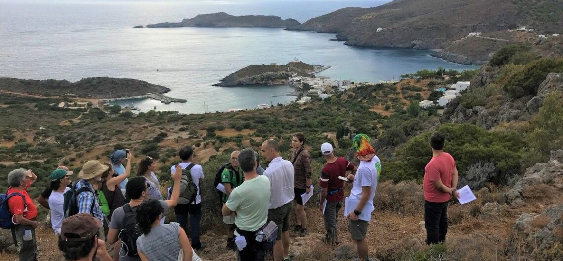
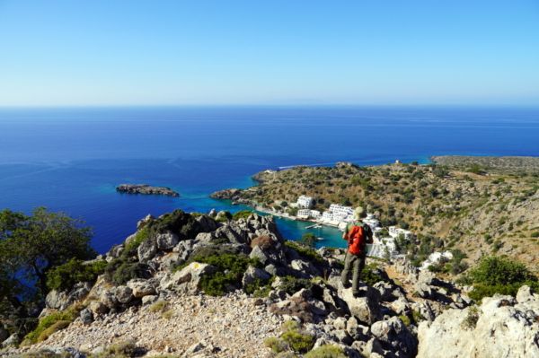
Kythera Trails becomes the 1st Green Flag certified trails in Europe In early October 2019, trail professionals from 13 countries gathered on the island of Kythera, Greece, for the training of trail auditors using the Green Flag Trails certification led by the World Trails Network. During the 7-days long course, a selection of Kythera’s trails were audited and three
Trail design, mapping & sign-posting workshop in Tirana Paths of Greece and Mr. Spyros Staridas (Staridas Geography) had been invited by the inspired team of Tirana Ekspres, in Albania for a workshop. The scope of the visit was a seminar about the use of GIS software, trail mapping and sign-posting preparations. The Tirana Ekspres team
The hotel certification standard has been launched! “Hikers’ Friendly” is a certification for services related to hiking activities. It is currently available only for hotels, but it will soon be open for other sectors. It has been developed by the Social Co-operative Paths of Greece, in collaboration with Green Evolution. Its aim is to enhance
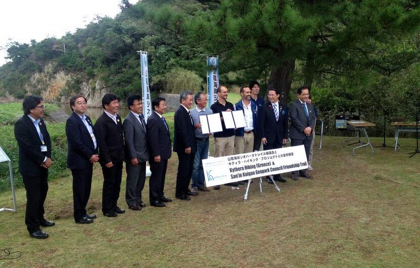
World Trails Conference and Friendship Trails The World Trails Network 6th World Trails Conference took place between the 14th and 17th of October 2016 in Tottori, Japan. During the conference, which attracted participants from over 30 countries, “Paths of Greece” gave a presentation titled “Utilizing 5000 year old trails for a better future”, analyzing Greece’s potential
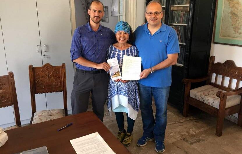
The first “Friendship Trail” in Greece! For the first time, a Greek trail signed the “Friendship Trail” agreement between trail #2 of Sifnos Trails and trail 18-1 of Jeju Olle trail (South Korea). In the context of the Friendship Trails programme of the World Trails Network, the Mayor of Sifnos, Mr Andreas Babounis and the
Digital Application for Sifnos island Trails! Sifnos becomes the first Greek island to have an application dedicated to its hiking trails. The application Sifnos Trails is a digital field guide for the trails network SifnosTrails. The total length of the network exceeds 100 km and is divided into 19 beautiful trails. The project started in
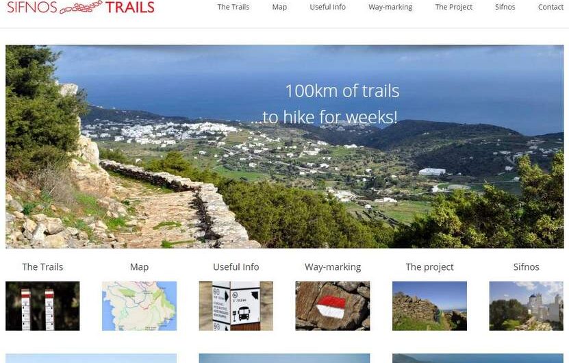
The new website www.sifnostrails.com ! The new website www.sifnostrails.com that we created, is now online! The website is only in English for now. A Greek, a French and a German versions will follow. On the website, we present the 19 officially way-marked trails of the island. On each trail page, you will find pictures, a description
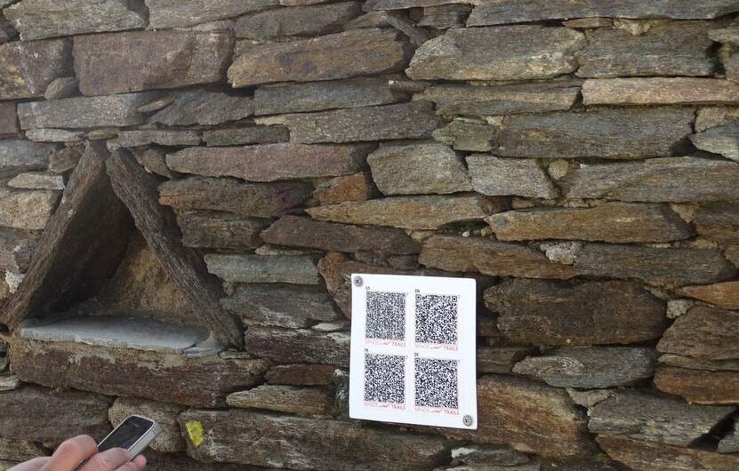
Innovation: Use of QR-codes in path signs Because a) we dont like to see many and big signs when we are walking in nature, b) we want people to know what the are looking at when they walk (caves, churches etc.) and c) we are more than cerain that in a few years almost everybody