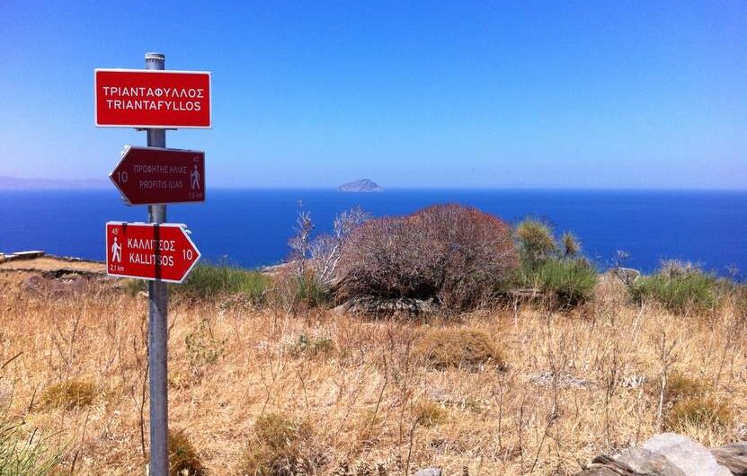
Serifos: Route #10 is ready! Of all of Serifos’ walking trails, this path surpasses most in natural landscape, geology and history. The trail starts near the picturesque village of Kallitsos and leads up towards the settlement of Ksero Chorio which was destroyed by pirate raids. On the first part of your journey you will pass
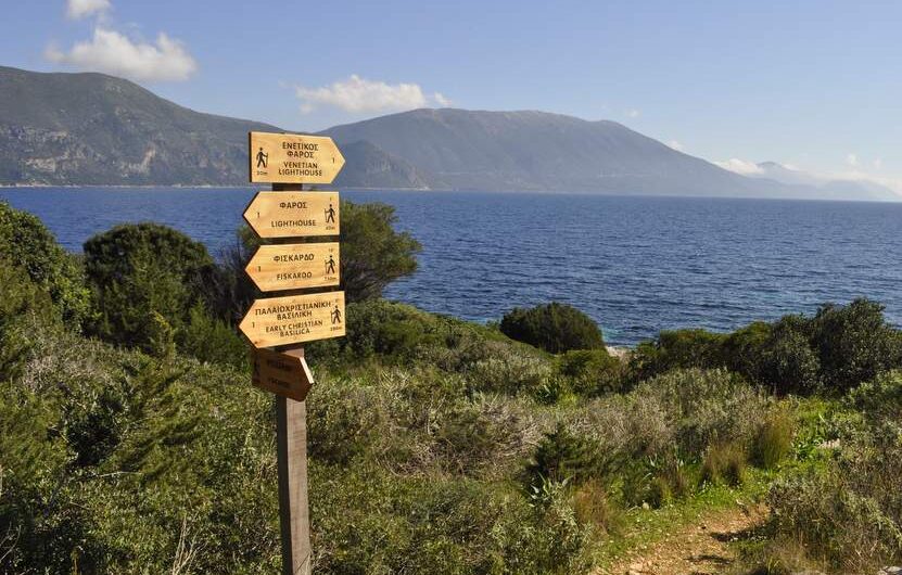
Kefalonia: Footpaths in Fiskardo! Working together with the Cultural and Environmental club of Erissos “Asteris”, we have completed, a few weeks ago, the sign-posting of a network of hiking trails in Fiskardo (or Fiscardo), in Kefalonia island. In total, we have sign-posted three trails of 850, 4,7 and 10km. While walking these paths, one can
Spring in Kythera During Easter 2014, and a few days later, we were on Kythera. At first, we were accompanying about 110 people from two greek hiking clubs. Together, we walked a few paths, we learned the story of the island as well as its myths, ancient and new ones. When the hiking clubs left
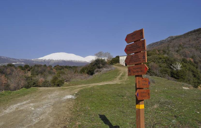
“Wet quarries” under the Falakro Mountain A few decades ago, one day, as the workers at the quarries were braking the marbles of the surface, instead of hitting a marble vein, they hit an underwater creek! Soon after, the water filled the quarry, and a new natural lake was born! In proximity to the Taxiarches
A video about our work! We have just finalised our first video about our work. You will see pictures and scenes from the research, the mapping, the sign-posting, the guided tours and the educational programmes that we have organised.
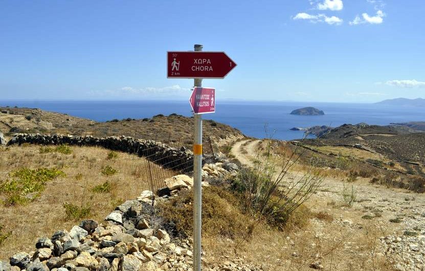
Sign-posting in Serifos In the summer of 2013, we have undertook the sign-posting of three hiking trails in Serifos island. The island’s hiking trails network has been previously sign-posted, but the signs became old and needed replacement. The new signs were sponsored by the company MEK Constructions, in collaboration with the Municipality of Serifos. We
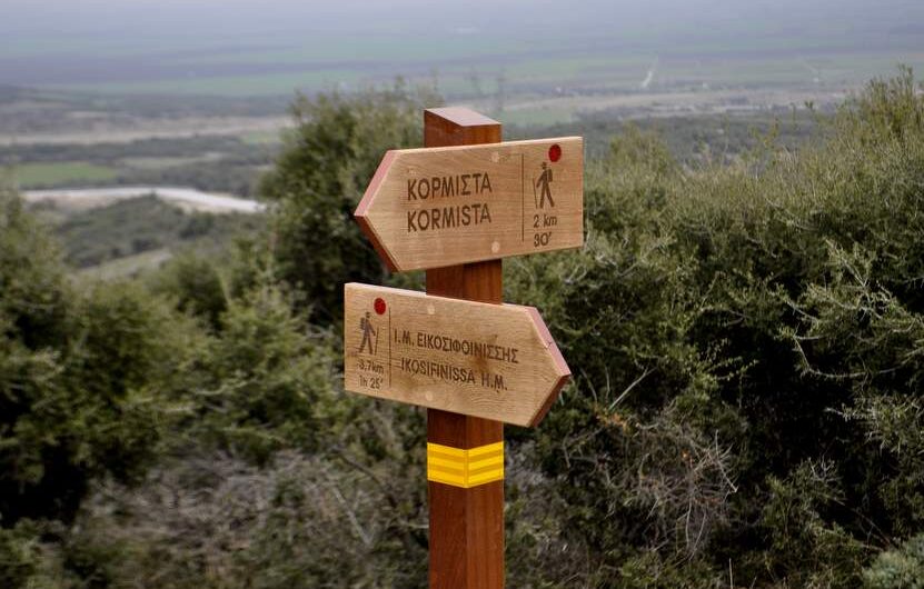
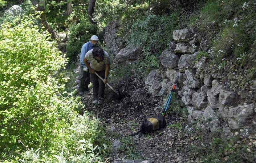
Sign-posting in Mt Paggaio A few days ago, we sign-posted the byzantine path leading to the Monastery of Ikosifoinissa in Mt. Paggaio. The path has been cleared, steps and bridges have been installed and now one can walk safely a 5,7 km long path, from Kormista village to the Monastery. For the sign-posting, we used
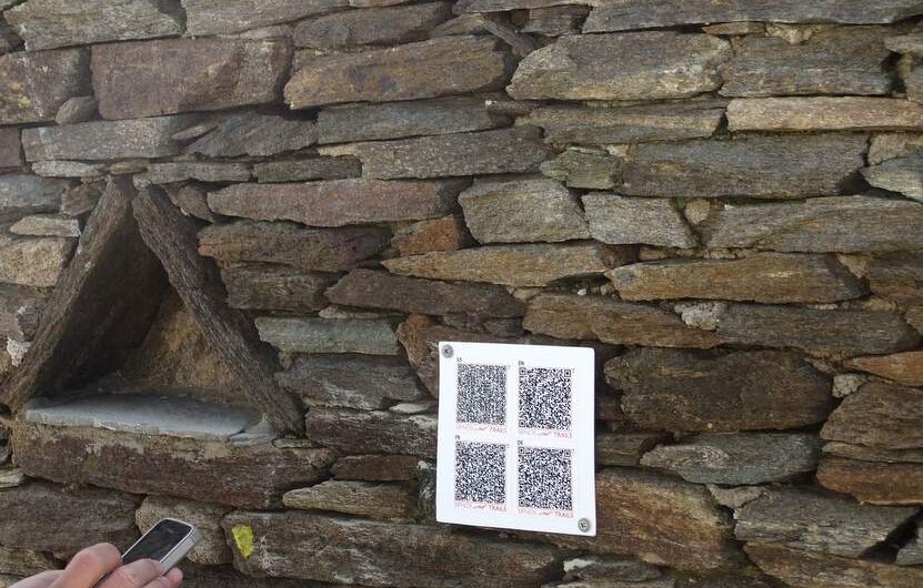
Innovation: Use of QR-codes in path signs Because a) we dont like to see many and big signs when we are walking in nature, b) we want people to know what the are looking at when they walk (caves, churches etc.) and c) we are more than cerain that in a few years almost everybody