Article in BBC Travel

The BBC Travel article “The island of Aphrodite’s ancestors”, presents Kythera through an authentic point of view. Through the view of a visitor who lived there a unique experience. The author, Katherine LaGrave, pays special attention to the hiking trails of Kythera. These trails have been organised by Paths of Greece, in collaboration with the Kytherian Foundation for Culture and Development. You can read the article at the following link: http://www.bbc.com/travel/feature/20131210-the-island-of-aphrodites-ancestors

Best wishes, with a poem!

We wish you a joyful New Year 2014! However, since joy is not entirely a matter of wishes and luck, but it also depends on our personal efforts, we dedicate to you this poem by the Spanish poet Antonio Machado (1875 – 1939):

..

..

“Traveler, there is no path”

..

Traveler, there is no path

Everything goes and everything stays

but our fate is to pass

to pass making a path as we go,

paths over the sea,

..

I never pursued glory,

or to leave on the memory

of the men,this my song:

I love the subtle worlds,

weightless and gentle

like soap bubbles.

..

I like to see them paint themselves on sun and crimson,

fly under a blue sky

shudder suddenly, and break…

I never pursued glory.

..

Traveler , your footprints are the path, and nothing else.

Traveler, there is no path. A path is made by walking.

..

A path is made by walking,

and in looking back one sees

the trodden road that never

will be set foot on again.

..

Traveler, there is no path, but wakes on the sea…

..

(Translation of the original “Caminante no hay camino” poem from Antonio Machado, taken from www.lyricstranslate.com)

Talking about paths… in a conference!

During the weekend from 7 to 8/12/2013, we took part in a highly interesting conference about the development of the paths of Greece. The conference was organized by the Greek-German Forum (www.grde.eu), and was held in Litochoro, in Olympus mountain. The speakers where greek and German. The Greek speakers presented the situation of hiking tourism in Greece, emphasizing on the huge potential of the country, as well as on the lack of proper organisation, knowledge and marketing skills. The German speakers represented German, Luxembourgish and European organisations. The presented very interesting elements concerning the correct development of a hiking trails network, from the clearing of the paths and the sign-posting, to marketing and tourism management. A special section was dedicated to the accessibility of the trails for people on wheelchair. We have all decided that this share of knowledge will not end with the end of the conference. Soon we will inform you about the next steps.

Crossing over Mt Ymittos

Towards the end of November 2013, we have completed the creation of a new path leading to the Trypia Spilia cave, in Mount Ymittos. This small section is part of a longer path that connects the small town of Koropi to Glyfada, on the other side of the mountain. The path starts near Koropi, on the ancient road of Sfittia. This road was used until the mid-19th century, where the farmers of Koropi would travel daily to Athens to sell their products (olives, grapes, figues and other). The path crosses the shortest pass of Mt Ymittos, called Stavros (454m). Stavros got its name from a metallic cross that was once installed over there.

Continuing the walk, we soon reach two small paths that lead to the caves of Mavrovouni and Stroggyli. Both of them are quite small. The Stroggyli cave requires a rope and climbing skills to be accessed.. A little later, we reach the new path that leads to the Trypia Spilia, the “Hollow cave”. It is called this way because its roof collapsed, leaving only the arc of its gate, thus creating an impressive natural monument. After a visit to the cave, one can descend towards Terpsithea neighborhood in Glyfada, passing by a beautiful pine tree forest and enjoyint views to the Saronic gulf and the Peloponnese.

Powered by Wikiloc

Sign-posting in Serifos

In the summer of 2013, we have undertook the sign-posting of three hiking trails in Serifos island. The island’s hiking trails network has been previously sign-posted, but the signs became old and needed replacement. The new signs were sponsored by the company MEK Constructions, in collaboration with the Municipality of Serifos. We have renewed the color signs, added directional as well as information signs at the beginning of each trail. We chose to use metallic signs instead of wooden ones, to be in line with the previous signalization, as well as because iron is one of the main products of the island.

We have also designed the new logo. It say “Walking Serifos – Paths of Iron and Stone”. Over the “Walking Serifos”, there is a little frog jumping, to connect the logo with nature and history, since the frog was the symbol of Serifos in ancient times. The subtitle “Paths of Iron and Stone” refers to the island’s geology as well as its Mythology. It is said that it is Serifos that Perseus petrified with the head of Medusa.

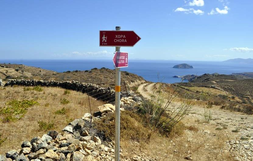
An unforgetable day in the Peloponnese

A few months ago, I had an amazing trip in the Peloponnese with Julio, my good Mexican friend. It was Julio’s second time in Greece, and we had decided to visit the Peloponnese and Epirus region. Our aim was to get as tired as possible from walks and scenery. Our Peloponnese trip lasted four days, and we saw the canal of Isthmos, Epidavros, Nafplion with its Castle, the picturesque villages of Mt. Parnonas, Monemvasia, Geraki, Taygetos Mt., Mani, Tainaron cap, Kalamata, Polylimnion, Pylos, Gialova, Voidokoilia, Olympia, Foloi as well as the villages of Kyllini Mt.
All of them are incredible places. Full of history. Places where nature embraces you and fills you in with energy and force. The funny thing is that one can easily repeat an equally amazing “tour of the Peloponese”, without really passing from the same monuments and places! But let us leave this for another time. Every day of this trip was full of surprises, but none was as an experience as the day described below, that left to both Julio and me, a feeling of endless joy. To me, it was certainly the most beautiful traveling day I ever had.
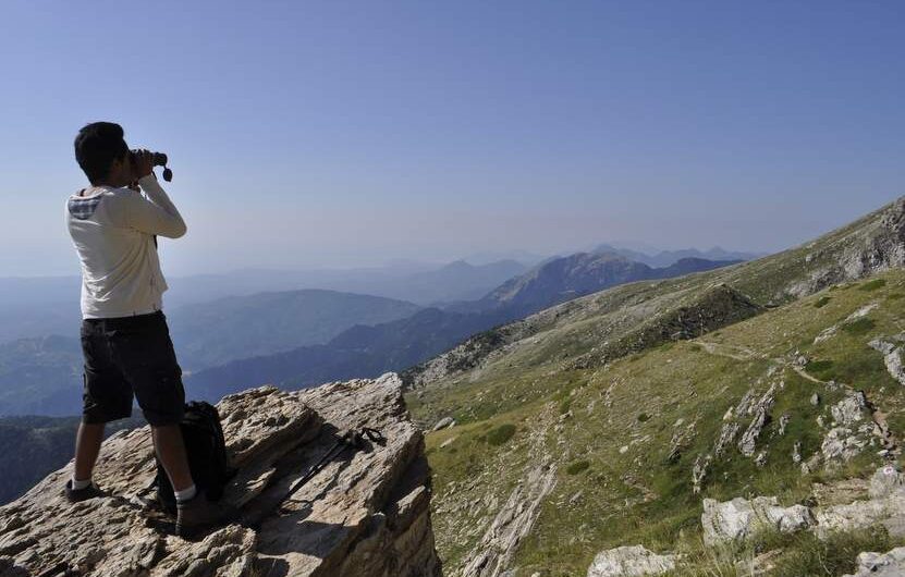
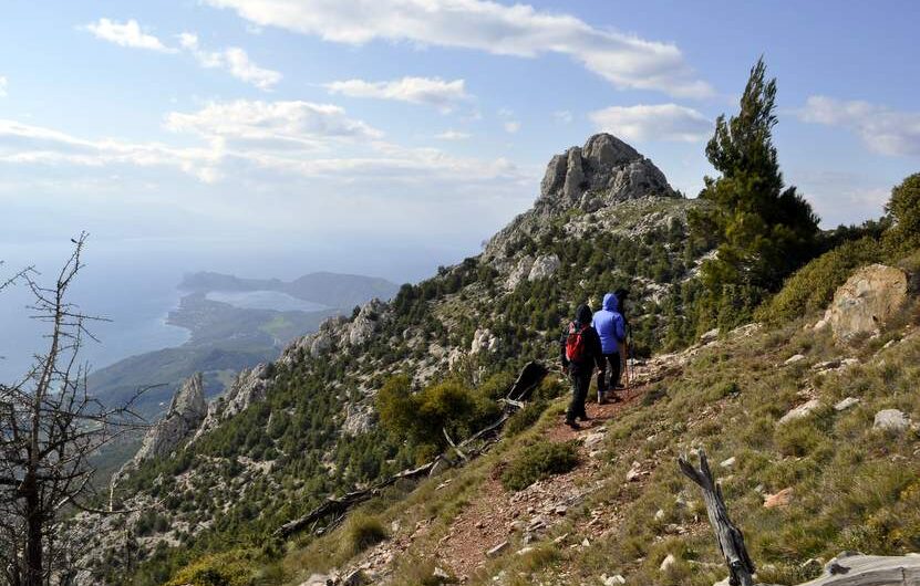
We woke up in our tents early in the morning, to see the sunrise from the mountain hut of Taygetos at 1600m of altitude. After a quick breakfast, we started our ascend to the peak of the holy mountain of ancient Spartans. The peak is called Profitis Ilias, as well as Pyramid, from some people who believe that it was carved by the Spartans. Why would they do such useless things, I don’t know!
A few hours later, we reached the peak of the mountain, and of the whole Peloponnese, at 2407m. The views from there are endless to all directions. Our cameras were on fire, but we also had some moments of thoughts, trying to feel the energy of the place. I attempted to travel back in time, and to get the feeling of majesty that ancient Spartans would feel when reaching this holy mountain top…
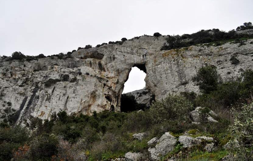
Time was pressing us, and we started our descent. To make it easy to leave this beautiful place, I promised to my self that I would visit it again soon. We reached the mountain hut about two hours later, and jumped in the Lada Niva that I had once again borrowed from my father. Our direction now was the cave of Diros. I had told nothing to Julio about the size of the cave, nor about the fact that we would have a subterranean boat trip of about 1km! We explored the miraculous cavities, our eyes still eager to see new images, even more impressive than the views we had in the morning. The best part of the cave, we both agreed, was the room with the “Golden Rain”. You will see it on one of the pictures below. When we finaly saw the exit of the cave, we thought that the surprises would be over. The crystal clear waters, the dry mountains of Mani and the colorful boats that were standing there proved us that anywhere we looked, the landscape will reward us.

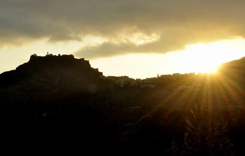
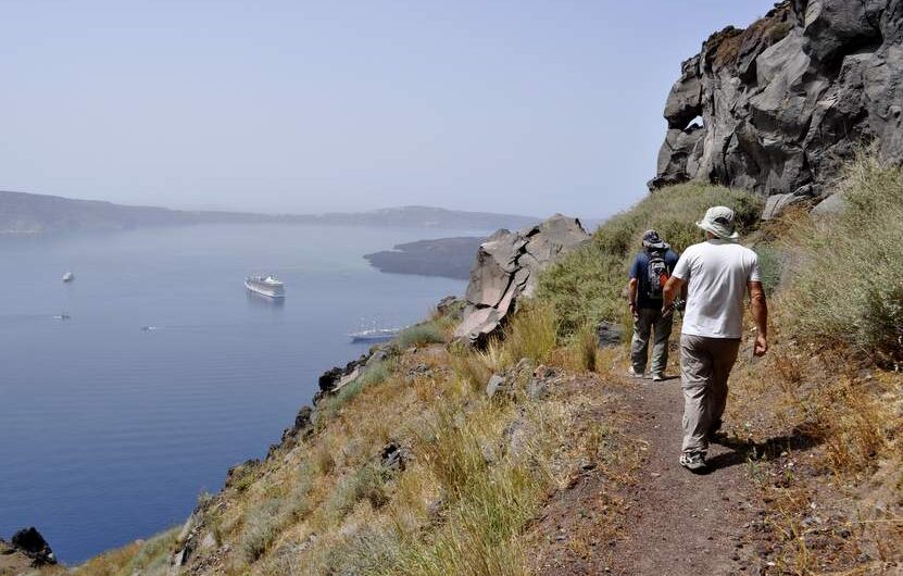
After Diros, and a quick swimming in the aforementioned waters, we continued the route to Vatheia, this 18th century castle village, with about 70 towers and houses, still standing on top of a hill, looking at the sea above. It is perhaps the most impressive of all tower villages in Mani, and this cost us about 150 pictures! But time was pressing for sunset, and we continued rapidly to the beginning of the path that would lead us to Cap Tainaron, the southernmost point of the Peloponnese. The path was beautiful, with small surprises here and there. We walked rapidly in order to be at the lighthouse before sunset. We made it about 25 minutes later! The sun was still there, ready to set. We were standing steel, looking at this majestic views, being at the very bottom of the beautiful Peloponnese, and recalling all these amazing moments we lived that day. Waking up on the highest peak of the region, having a boat trip inside the deepest part of the Peloponnese, and reaching its southernmost point. Three extremes, full of energy, full of hope. That was, until now, my best day of traveling.

Santorini – Discovering its authentic side

During May, we have visited the beautiful island of Santorini to record hiking trails with our GPS. In colaboration with Mr. Kostas Zarokostas, who has undertaken the sign-posting of the paths of Santorini, we have recorder many kilometers of trails in order to produce a map and to enrich the signage with information on distances and walking times.

This route is an easy and spectacular walk in the heart of the Sounion National Park. Amongst the sites, you will see the gulch of Chaos, the tunnels of the iron mines of the 20th century and the washing plants of the ancient mines of Lavrion. The trail starts not far from the Agios Constantinos village, where there is plenty of space for parking. At first, the walk surrounds the impressive gulch of Chaos, with steep cliffs that reach 70m in height. In ancient times the gulch did not exist It was an unknown cave which roof collapsed, most probably because of the ancient mining tunnels that destabilized it. Indeed, if you look carefully at the cliffs, you will certainly see some of these tunnels. The ancient mines of Lavrion offered to Classical Athens the richness that raised it to a superpower. In these mines thousands were the slaves that everyday would get inside the tunnels to dig out the precious material, very often never getting out themselves.
The trail continues for a few meters on tarmac. From there the view opens, and you can see the city of Lavrion and its port, as well as the islands of Makronisos and on the background Kea (Tzia). A little further down, the trail continues on the old road of the 20th century mines. This part of the trail is very impressive as you can see all around the place the numerous extractions of the “modern” mines. Lavrion mines were in use between 1864 and the end of the 20th century. The path crosses the main road once more to arrive at some old houses of miners, now in ruins.
Using the same old road, the path arrives at the church of Agia Triada, were you can have a stop and drink some water from the natural spring. From Agia Triada, a dirt road leads to the ancient mines washing plants. The area is protected by a fence, but the gate is open! In it you’ll see the impressive water tanks as well as the plants were the ancient workers (slaves) would separate the useful material from scrap. Have a nice walk!

Powered by Wikiloc

Breathtaking views on Mount Geraneia

This is an excellent trail to escape from Athens on a one-day trip. It offers an amazing view on the gulfs of Corinth and Saronicos, as well as on all the surrounding mountains. This trail starts at Pisia village, climbing the mountain rather steeply at the beginning. Soon though, the “balconies” will start, with breathtaking views. Small plateaus with pine and fir trees, make the ascend to the Pintiza peak (1032 m.) easier. The trail continues by a cliff, offering probably the most amazing view one can expect towards Corinth, the sunken lake “Vouliagmeni” and the sea. Then it returns back to the village of Pisia. The Geraneia mountains range is a NATURA 2000 area, with more than 950 species of plants.

Powered by Wikiloc

Seeking an anciend Path

At the end of February we explored the area called Douka, in Ymittos Mt. in order to trace the ancient Sfitteia road (path) that linked Athens to the Demos of Kropia (today’s Koropi). The area is locked between the peaks Profitis Ilias and Mavrovouni, both belonging to the Ymittos Mt. The Sfiteia path, according to information, was calmly ascending the slope, crossed the Stavros col and then descended towards Athens. Finding it proved difficult. On the one hand vegetation was very dense. On the other, we believe that older inhabitants of the area used the stones that once hold the ancient path, in order to create cultivation beds on the slope. In several places though, the path is clearly visible. Soon, it will be cleared and sign-posted.