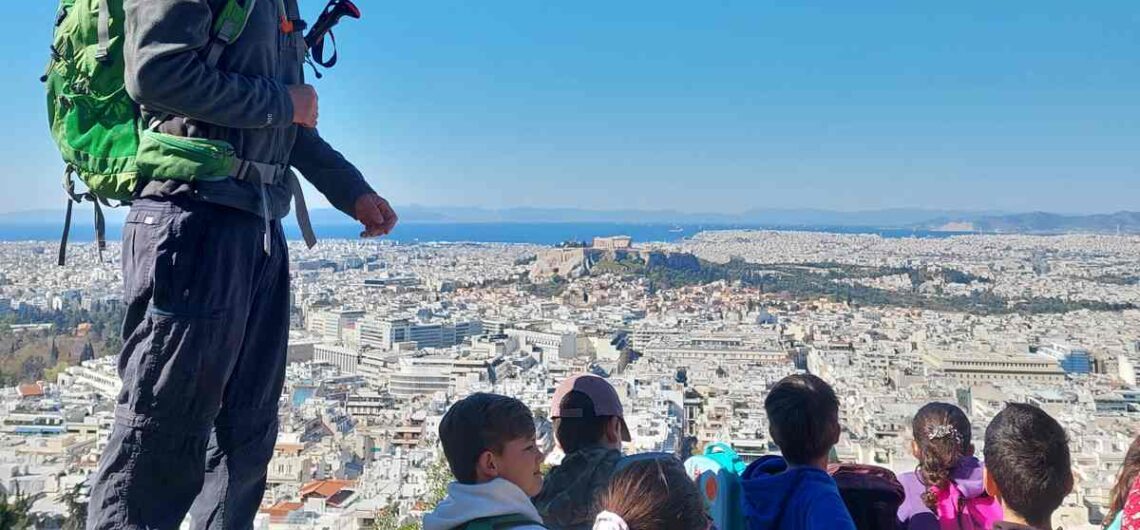
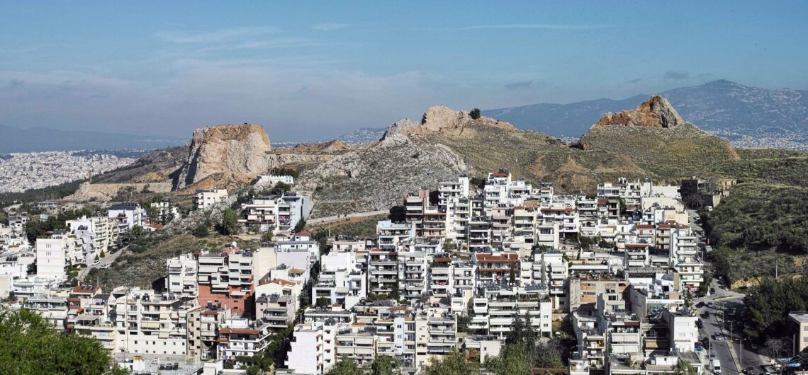
Educational program: “Exploring the hill of Lycabettus” On March 30, the first step was taken in a plan that had started before the appearance of Covid-19 in our lives. That is the educational program: “Exploring the hill of Lycabettus” that we developed, in collaboration with teachers, through which we aim to bring children into
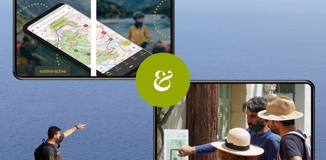
Partnership with Outdooractive In February 2023, our collaboration with the global platform outdooractive.DACH, which specializes in all types of adventure tourism, officially began. We came into contact during the World Trails Network Conference, which took place in Skiathos in the summer of 2022, with the aim of contributing to the accurate and detailed depiction of Greek

International tourism exhibitions At the beginning of the year, some of the most important international tourism exhibitions take part. We participated in three of them, representing Greek destinations with which we have collaborated in the past to create hiking networks. The first exhibition was Fiets en Wandelbeurs Nederland in Utrecht, Netherlands, February 25-26. Its
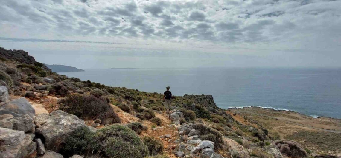
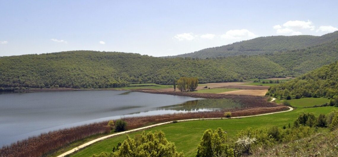
Trail scouting in Lasithi The Paths of Greece team spent a month in the regional unit of Lasithi, in Eastern Crete, to survey the paths and plan the new trail network of the area. This is a different study from the ones we are used to carrying out, as the large extent of the
2022 Recap In 2022 the Social Cooperative Enterprise Paths of Greece remained very active. Coming out of the Covid-19 era, our top priority was to expand and add to our team. Thus, now Paths of Greece fully employs 7 employees, while at the same time the collaboration with a large number of external partners
Trail waymarking materials After having examined the technical characteristics of waymarks, let’s see what are the waymarking materials that we suggest. In the beginning, at Paths of Greece we used aluminum signs, colored with the silk print method. Their dimensions were 6,5 x 13 x 0,2cm. We used inox screws to screw them on rocks
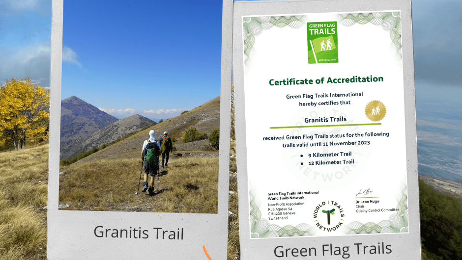
Granitis Trail Certification The second Green Flag Trails certification in Greece is a fact! The Granitis Trail has been officialy certified with the only global certification for trails, the Green Flag Trails! Thanks to the tremendous efforts of Nikos Bourlivas, who has created the Granitis Trail, and the kind sponsorship and support Raycap, the trail has been
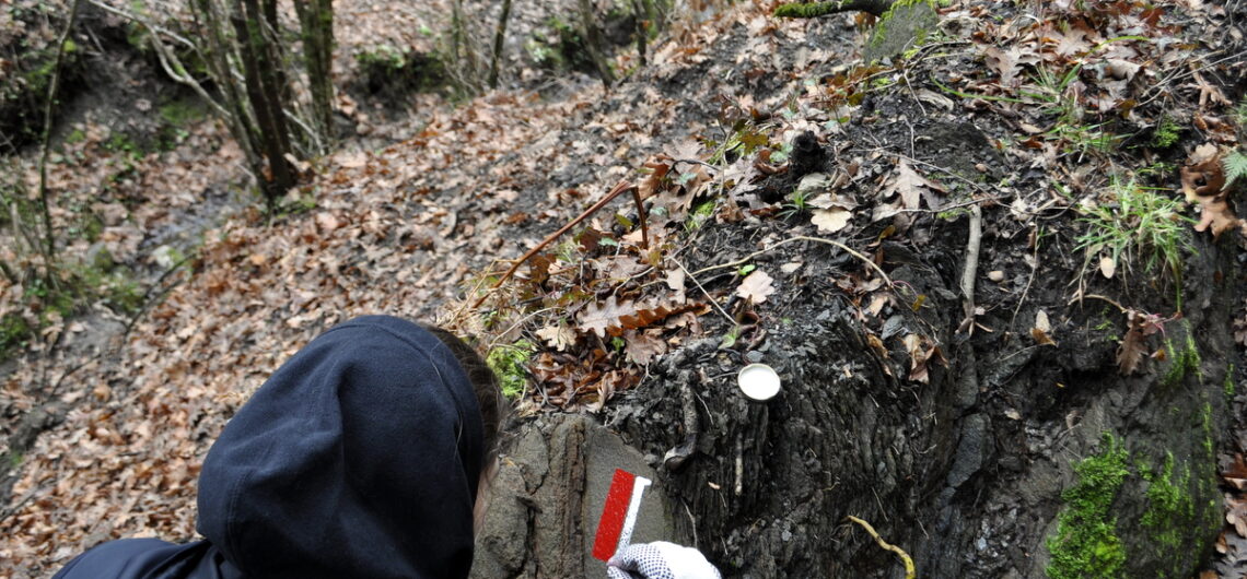
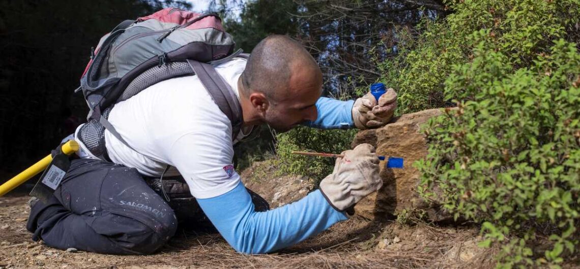
Trail Waymarking What is considered to be a good waymarking? The answer is one: “Waymarks that a hiker can easily understand and seamlessly follow”. In this article series we will attempt to present the thematic of trail signage with examples and pictures. In this article we will speak about waymarking with paint or small
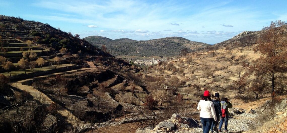
Trails and Wildfires A difficult and cruel Greek summer is slowly coming to its end. A summer stigmatized by the prolonged, exhausting heatwave in many parts of the country, but mostly by the smoke of wildfires, keeping our mind focused on the climate crisis that makes its face increasingly obvious. Our hearts and minds
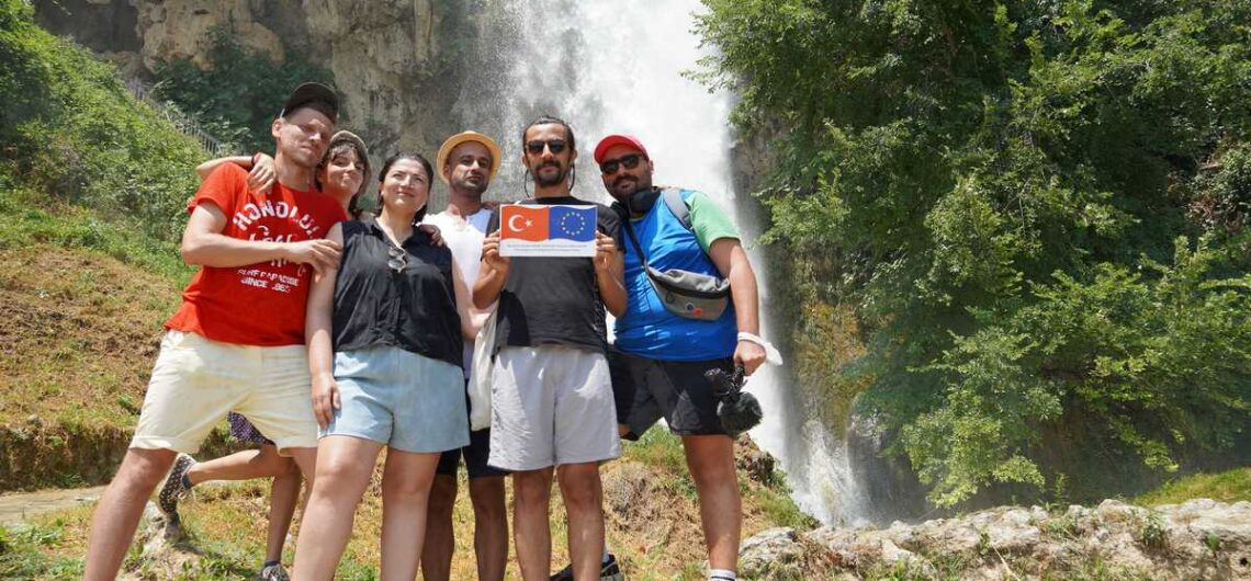
Performative Journey EU Project With our partners MitOst (Germany), Culture Routes Society (Turkey) and Tirana Ekspres (Albania), who are committed in the development of Via Eurasia – a long-distance cultural route and walking trail running from Rome, across Italy and the Balkans, through western Turkey to Demre on the Lycian coast of Turkey’s southwest and beyond we are working on an EU

Bike Friendly – Paths of Greece Paths of Greece and Bike Friendly Hotels have signed a Memorandum of understanding for their close co-operation in the fields of developping cycling destinations. Through their co-operation, both organisations have agreed to work closely in promoting cycling tourism, creating adequate infrastructure and develop a network of high quality
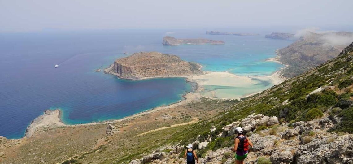
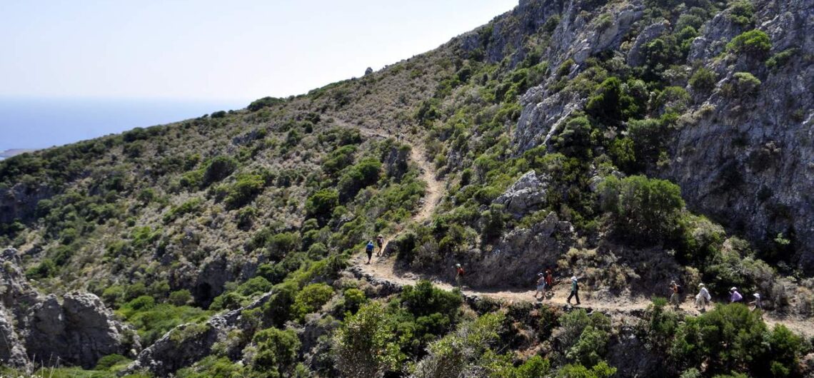
Trail planning in Kisamos Paths of Grecce’s team has been trail planning for about a month in Kisamos, western Crete, in order to design the new hiking network of the area. For several days, Konstantinos, Ioanna, Vasilis and Guest Star Helen, have explored every single bit of the Kisamos Municipality, have tracked the trails
New Kythera Trails Videos Check out the new set of videos produced for the Kythera Trails. Some of these have been created and some co-funded by Paths of Greece.
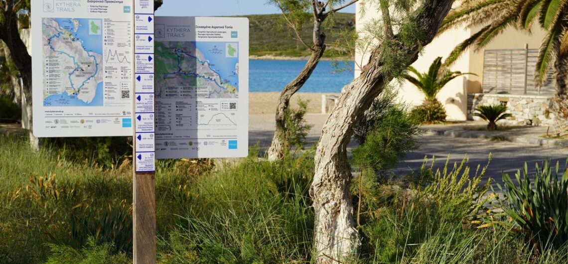
New trailhead signs for Kythera Trails New trailhead signs have been installed on the Kythera Trails Network! 24 trailhead signs have been installed in 16 traditional villages, welcoming hikers on the 11 trails of the network. The signs boast the logo of the identity of each trail, with plenty of information being at the
Metropolitan Trails Academy Launch In the last two years, the European network of metropolitan trails designers, located in Athens, Köln, London, Milano, and Marseilles, has prepared online teaching tools to enable the creation of metropolitan trails in new cities. In this prospect, we recently opened the online version of the Metropolitan Trails Academy and invite you
Cycling Trails in the Peloponnese The beauty of Greece lies in its most unexpected places. Enjoy this short video that we shot while cycling in the mountainous part of Messinia, Peloponnese, Greece. Paths of Greece has been recently exploring the mountainous Messinia region in order to design a cycling trails network, to complete the Apollo Trails hiking
Paths of Peace This article, available in the Greek version of our website, presents the Paths of Peace project, in northern Greece. The trails are amongst the most impressive one can find in the mountainous regions of Greece. For more information visit the website www.pathsofpeace.gr
10 years Paths of Greece! In 2021 the Social Cooperative Enterprise “Paths of Greece” celebrates its 10th anniversary! We recall the experiences and emotions we experienced in this process: The emotions we felt looking for paths lost in time and the stories of the past, the stories we learned in our encounters with local
A Path for the Disabled as Skiathos Trails enter a new Era In 2021, the walking trails of Skiathos will be ready for hikers to explore this beautiful island. Their total length exceeds 100 kilometers. Paths of Greece has recently conducted the study of the project, which includes the re-shaping of the trails network, infrastructure
Trail Certifications This article is available only in Greek for the moment. It treats of the different certifications systems that are available for trails in Greece.